Entronque de Herradura
| Entronque de Herradura | |
|---|---|
| Village | |
|
Entronque de Herradura | |
| Nickname(s): Little Miami | |
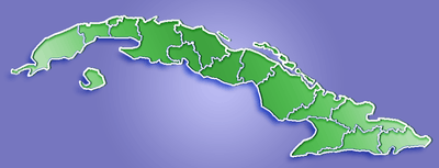 Entronque de Herradura Location of Entronque de Herradura in Cuba | |
| Coordinates: 22°34′25″N 83°27′09″W / 22.57361°N 83.45250°WCoordinates: 22°34′25″N 83°27′09″W / 22.57361°N 83.45250°W | |
| Country |
|
| Province | Pinar del Río |
| Municipality | Consolación del Sur |
| Settled | 1907 |
| District | 1988 |
| Area | |
| • Total | 59.84 km2 (23.10 sq mi) |
| Elevation | 71 m (233 ft) |
| Population | |
| • Total | 9,828 |
| • Density | 164.24/km2 (425.4/sq mi) |
| • Demonym | Entronqueño |
| Time zone | EST (UTC-5) |
| • Summer (DST) | EDT (UTC-4) |
| Postal code | 24490[1] |
| Area code(s) | +53-48 |

Entronque de Herradura is one of thirteen villages (consejos populares) belonging to Consolación del Sur, in Pinar del Río Province, Cuba. It has a land extension of 59,84 km² (23.1 square of miles).
Geography
It covers the northeast part of Consolación del Sur, bordered on the north by the municipality of La Palma and Los Palacios, east of Canal, on the south by the border of Herradura, by the West with the district of Crucero de Echeverria.[2]
Demography
It has a population about 9,828 inhabitants with a density of 164.24 inhabitants per km². The population is distributed as follows, 78.8% live in urban areas for a total 7428 population and 21.1% living in rural areas with a total of 1987 inhabitants. There are a total of 3349 house units, which 77.4% are urban and 22.6% are in remote rural area.
See also
References
- ↑ "Entronque de Herradura postal code".
- ↑ "Guije" (in Spanish).
External links
![]() Media related to Entronque de Herradura at Wikimedia Commons
Media related to Entronque de Herradura at Wikimedia Commons