Erstfeld
| Erstfeld | ||
|---|---|---|
 | ||
| ||
 Erstfeld | ||
|
Location of Erstfeld 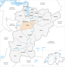 | ||
| Coordinates: 46°49′N 8°39′E / 46.817°N 8.650°ECoordinates: 46°49′N 8°39′E / 46.817°N 8.650°E | ||
| Country | Switzerland | |
| Canton | Uri | |
| District | n.a. | |
| Area[1] | ||
| • Total | 59.12 km2 (22.83 sq mi) | |
| Elevation | 475 m (1,558 ft) | |
| Population (Dec 2015[2]) | ||
| • Total | 3,774 | |
| • Density | 64/km2 (170/sq mi) | |
| Postal code | 6472 | |
| SFOS number | 1206 | |
| Surrounded by | Attinghausen, Gurtnellen, Schattdorf, Silenen, Wassen | |
| Website |
www SFSO statistics | |

Erstfeld is a municipality in the canton of Uri in Switzerland.
History
Erstfeld is first mentioned in 1258 as Ourzcvelt. In 1638, it was listed under the Latin name in Protocampis. In 1831, it was known as Hirschfelden.
Geography
Erstfeld has an area, as of 2006, of 59.2 km2 (22.9 sq mi). Of this area, 11.7% is used for agricultural purposes, while 29.2% is forested. Of the rest of the land, 2.8% is settled (buildings or roads) and the remainder (56.2%) is non-productive (rivers, glaciers or mountains).[3] In the 1993/97 land survey, 19.8% of the total land area was heavily forested, while 7.9% is covered in small trees and shrubbery. Of the agricultural land, 0.2% is used for farming or pastures, while 5.3% is used for orchards or vine crops and 6.3% is used for alpine pastures. Of the settled areas, 1.2% is covered with buildings, 0.3% is industrial, 0.1% is listed as parks and greenbelts and 1.2% is transportation infrastructure. Of the unproductive areas, 0.1% is unproductive standing water (ponds or lakes), 0.9% is unproductive flowing water (rivers), 41.8% is too rocky for vegetation, and 13.3% is other unproductive land.[4]
The municipality consists of the linear village of Erstfeld and scattered farm houses along the valley floor and up the mountain sides.
Erstfeld is at the base of the northern ramp of the Gotthard railway and houses all the rolling stock needed for the rail line.
Population
| Historical population | ||
|---|---|---|
| Year | Pop. | ±% |
| 1743 | 614 | — |
| 1799 | 700 | +14.0% |
| 1850 | 916 | +30.9% |
| 1880 | 1,184 | +29.3% |
| 1900 | 2,416 | +104.1% |
| 1910 | 3,149 | +30.3% |
| 1950 | 3,747 | +19.0% |
| 1970 | 4,516 | +20.5% |
| 2000 | 3,933 | −12.9% |
| 2005 | 3,778 | −3.9% |
| 2007 | 3,715 | −1.7% |
Erstfeld has a population (as of 31 December 2015) of 3,774.[5] As of 2007, 13.3% of the population was made up of foreign nationals. Over the last 10 years, the population has decreased at a rate of -10.8%. Most of the population (as of 2000) speaks German (88.7%), with Serbo-Croatian being second most common (3.7%), and Italian being third (2.4%).[3] As of 2007, the gender distribution of the population was 50.6% male and 49.4% female.[6]
In Erstfeld, about 60.8% of the population (between age 25-64) have completed either non-mandatory upper secondary education or additional higher education (either university or a Fachhochschule).[3]
Erstfeld has an unemployment rate of 1.94%. As of 2005, there were 119 people employed in the primary economic sector and about 47 businesses involved in this sector. About 643 people are employed in the secondary sector, and there are 38 businesses in this sector. About 870 people are employed in the tertiary sector, with 86 businesses in this sector.[3]
Transport
Erstfeld is served by the Erstfeld station, situated within the municipality and on the Gotthard railway.
Notable residents
- Emilie Lieberherr (1924–2011), a feminist
- Albert Eschenmoser (born 1925), an organic chemist
References
- ↑ Arealstatistik Standard - Gemeindedaten nach 4 Hauptbereichen
- ↑ Swiss Federal Statistical Office - STAT-TAB, online database – Ständige und nichtständige Wohnbevölkerung nach institutionellen Gliederungen, Geburtsort und Staatsangehörigkeit (German) accessed 30 August 2016
- 1 2 3 4 Swiss Federal Statistical Office accessed 09-Sep-2009
- ↑ Canton Uri - Ground use statistics (German) accessed 8 September 2009
- ↑ Swiss Federal Statistical Office - STAT-TAB, online database – Ständige und nichtständige Wohnbevölkerung nach institutionellen Gliederungen, Geburtsort und Staatsangehörigkeit (German) accessed 30 August 2016
- ↑ Uri Population statistics (German) accessed 8 September 2009
External links
| Wikimedia Commons has media related to Erstfeld. |
- Erstfeld in German, French and Italian in the online Historical Dictionary of Switzerland.