Essipit, Quebec
| Essipit | |
|---|---|
| Indian reserve | |
 | |
 Essipit | |
| Coordinates: 48°20′N 69°24′W / 48.333°N 69.400°WCoordinates: 48°20′N 69°24′W / 48.333°N 69.400°W | |
| Country |
|
| Province |
|
| Region | Côte-Nord |
| Regional county | None |
| Formed | 1892 (reserve) |
| Government[1][2] | |
| • Chief | Denis Ross |
| • Federal riding |
Montmorency—Charlevoix —Haute-Côte-Nord |
| • Prov. riding | René-Lévesque |
| Area[3] | |
| • Land | 1.10 km2 (0.42 sq mi) |
| Population (2006)[3] | |
| • Total | 268 |
| • Density | 224.2/km2 (581/sq mi) |
| Time zone | EST (UTC-5) |
| • Summer (DST) | EDT (UTC-4) |
| Postal Code | G0T 1K0 |
| Area code(s) | 418 and 581 |
| Website | www.innu-essipit.com |
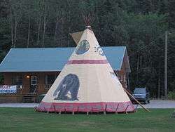
Essipit (known as Les Escoumins until 1996) is an Innu Indian reserve and community in the Canadian province of Quebec, located on the north shore of the Gulf of Saint Lawrence in the Côte-Nord region. It belongs to the Innue Essipit First Nation.
The reserve is named after the historical name of the Escoumins River, that around 1664, was known as Esseigiou. Charles Arnaud, who spent many years of his life among the Montagnais stated that the river was also called Etshipi, meaning "river of shells".[4]
History
The Montagnais have frequented the place for thousands of years, gathering berries that covered the rocks and adorned the mossy plains in the spring. The Jesuit Relations reported on the presence of "Excomminquois" in the region since 1611. It presented them however as an enemy nation of the French and distinguished them from the Montagnais of the region who were recognized as friends. It is assumed that they likely were Mi'kmaq tribes that from the middle of the 16th century onwards sporadically left their territory around Chaleur Bay and visited the North Shore of the Saint Lawrence Gulf.[4]
In 1863, about 40 Montagnais people were counted at the Mission of Escoumins. In 1881, the Superintendent of Indian Affairs appointed surveyor Elzéar Boivin to delineate the land occupied by them. On July 23, 1892, the Government of Canada purchased the land and the Réserve indienne des Escoumins (Escoumins Indian Reserve) was formed.[4][5]
In 1994, the reserve changed its name to Communauté montagnaise Essipit, made official by Commission de toponymie du Québec on June 7, 1996. On August 7, 2003, the name was changed again, and it is now known as Innue Essipit.[4][5]
Demographics
Reserve population trend:[6][7]
- Population in 2011: 268
- Population in 2006: 247 (2001 to 2006 population change: -4.3 %)
- Population in 2001: 258
- Population in 1996: 252
- Population in 1991: 238
Private dwellings occupied by usual residents: 105 (total dwellings: 107)
The total population of the Essipit First Nation is 429, with only 176 band members living on the reserve.[2]
References
- ↑ Ministère des Affaires Municipales, Régions et Occupation du territoire - Répertoire des municipalités: Essipit
- 1 2 "Essipit First Nation". Aboriginal Community profiles. Indian and Northern Affairs Canada. Retrieved 2010-06-15.
- 1 2 Statistics Canada 2006 Census - Essipit community profile
- 1 2 3 4 "Essipit (Réserve indienne)" (in French). Commission de toponymie du Québec. Retrieved 2010-06-15.
- 1 2 Natural Resources Canada - Legal Surveys Division, Historical Review - Innue Essipit
- ↑ Statistics Canada: 1996, 2001, 2006 census
- ↑ http://www12.statcan.gc.ca/mobile/2011/cp-pr/table-eng.cfm?SGC=2495802
External links
 |
Les Escoumins | | ||
| Les Escoumins | |
Saint Lawrence River | ||
| ||||
| | ||||
| Les Escoumins |
Innu language Naskapi language Nitassinan Innu music Northeastern Quebec Agreement (1978) Côte-Nord Eastern Labrador | ||
| First Nations (Indian bands) |  | |
| Communities |
| |
See also: Category:Innu Category:Naskapi | ||
| Regional county municipalities and equivalent territories | |
|---|---|
| Municipalities | |