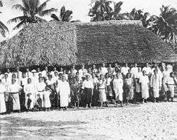
Falefa
Falefa is a village on the north east coast of Upolu island in Samoa.[1] The village is part of the electoral constituency (Faipule District) Anoamaa East which is within the larger political district of Atua. Geographically, it is one of the oldest and largest villages in Samoa, at one point stretching from its ancient border with Uafato to Saolufata, until portion of these lands were given to form the settlements of Falevao, Lufilufi, Falepuna, Sauano & Saletele which came about in later centuries. Falefa was founded by two brothers in the 13th century - Moeono & Leutele, who had left their birthplace at Uafato (Fagaloa) and were headed west along the mountain ranges of Le Mafa pass.
Falefa means the 'Four Houses', indicative of the four sub-villages which make up the village itself; Sanone, Gagaemalae, Saleapaga, Sagapolu. Each of these sub villages comprise families, the heads of which, represent their extended families and their respective area at Falefa's Village Council, headed by the two senior tulafale alii of the village, Moeono & Iuli.
In Ancient times, Falefa was given the honour of being the seat of the King, Tupu Tafa'ifa Fonoti, to whom he gave it the title, 'Aai o Fonoti' - King Fonoti's City, in recognition of the bravery of its warriors who were instrumental in his victory over the forces of Va'afusuaga Tole'afoa and Samala'ulu.
FAALUPEGA O FALEFA
Tulouna a le aai o Fonoti ma fale e fagafua
a oulua matua: Iuli ma Moe’ono
a Fulumu’a na falelimaa’I fetalaiga ia te oe le Aai
Tulouna a le putuputu o tagata o le Tuiatua
Afio mai sa Fenunuivao
mai Leutele o le tina o Tupua
mai Lealaisalanoa o le tei o Tupua o le tama a Malili e fa
Mai Alai’asa na fita I tuga
mai Luafalemana o le Aloalii
The population is 1,387 (2006 Census).[2]
South of the village settlement is Falefa Valley.
See also
References
- ↑ "Samoa Territorial Constituencies Act 1963". Pacific Islands Legal Information Institute. Retrieved 18 December 2009.
- ↑ "Population and Housing Census Report 2006" (PDF). Samoa Bureau of Statistics. July 2008. Retrieved 16 December 2009.
Coordinates: 13°53′S 171°33′W / 13.883°S 171.550°W
Traditional center: Lufilufi | ||
| Villages |  | |
| Landmarks | ||
| Islands |
| |
| Environment | ||
| Electoral constituencies: Faipule Districts |
| |