Fenham
| Fenham | |
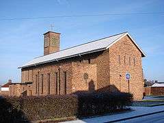 Church of the Holy Cross |
|
 Fenham |
|
| Population | 10,954 (2011.ward)[1] |
|---|---|
| OS grid reference | NZ220656 |
| Metropolitan borough | Newcastle upon Tyne |
| Metropolitan county | Tyne and Wear |
| Region | North East |
| Country | England |
| Sovereign state | United Kingdom |
| Post town | NEWCASTLE UPON TYNE |
| Postcode district | NE4 |
| Dialling code | 0191 |
| Police | Northumbria |
| Fire | Tyne and Wear |
| Ambulance | North East |
| EU Parliament | North East England |
| UK Parliament | Newcastle upon Tyne Central |
|
|
Coordinates: 54°59′05″N 1°39′19″W / 54.9848°N 1.6553°W
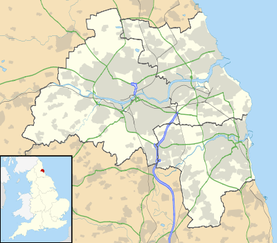
Fenham is an area of the west end of Newcastle upon Tyne, England. It lies to the west of the city centre, and is bounded on the north and east by a large area of open land known as the Town Moor. To the south lies Benwell, whilst West Denton lies to the west, Blakelaw and Cowgate to the north, and Arthur's Hill and Spital Tongues to the east. The area has an ethnically mixed population, and is also home to a large number of students.
The area covers two wards of Newcastle: Wingrove Ward, and Fenham Ward.
History
Fenham grew up as a separate township from Newcastle, lying on the western outskirts of the city. Much of the land originally belonged to religious charitable institutions, and there are covenant restrictions on the building of any licensed premises. In 1895 Benwell and Fenham Urban District was created; in 1904 the area was incorporated into Newcastle upon Tyne.
Fenham did not become a residential area until the 20th Century. Housing was built on a large scale when tram lines were extended from Central Station via Barrack Road. Further expansion was facilitated by the development of trolley buses and bus links to Westerhope.[2]
The BBC Broadcasting Centre, located just North of Fenham Barracks, on Barrack Road houses Radio Newcastle and Look North.
Local Amenities
Fenham possesses a public library on Fenham Hall Drive. The library is currently closed for refurbishment and will reopen as a partnership venture between the City Council and Your Homes Newcastle in March 2014.[3] Fenham has an active residents group called Fenham Association of Residents that launched the FAR Community Centre in 2001. The FAR Community Centre offers activities for all age groups offering activities aimed at helping residents improve their self-esteem and skills. There is also a public swimming pool, since August 2005 run as a community organisation. The pool was shut in 2003, but in 2004 the Liberal Democrats took control of Newcastle City Council from Labour; one of their pledges was to re-open Fenham pool, which was achieved with substantial financial backing from residents of the local community.
The main local schools include Westgate Community College on West Road, Saint Cuthberts RC High School on Gretna Road and Sacred Heart RC High School. There are also some private schools situated in Fenham, one is Dame Allan's on Fowberry Crescent.
Ethnic minority
Today Fenham is most well known in the local area for its large Asian community with many of the businesses in the area being Asian-owned and including many specialty stores such as a halal butchers and Asian jewellery and clothing stores. There are many ethnic minority groups living side by side in Fenham with a significant number of people being of either Pakistani or Bangladeshi origin.
Councillors
There are three councillors for the Fenham electoral ward: Helen McStravick, Matthew Myers and Marion Talbot, who all represent the Labour Party. Marion Talbot won election in May 2012 securing 1735 votes beating her nearest rival PJ Morrissey in second on 643 votes. Talbot has since been elected to an Executive post of Performance and Resources Portfolio.
References
- ↑ "Ward population 2011". Retrieved 5 July 2015.
- ↑ "Your Details - for your ward". newcastle.gov.uk. Retrieved 12 December 2015.
- ↑ "Fenham Library | Newcastle City Council". Newcastle.gov.uk. 2014-07-03. Retrieved 2015-12-12.
External links
- Census results for the wards of Newcastle
- Fenham Pool
- Photographic tour
- St Roberts Roman Catholic Church
- St James and St Basil(Church of England) Church
- Blakelaw and North Fenham Parish Council
- Fenham Association of Residents FAR
- Fenham Life, from people of Fenham