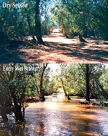
Finniss River (Northern Territory)
The Finniss River is a river south of Darwin, running west through Litchfield National Park and flowing into the sea at Fog Bay.[1] The East Branch of the Finniss was heavily polluted during the 1970s due to uranium mining at Rum Jungle mine about 105 km south of Darwin. The Finniss River Land Claim was presented to Judge John Toohey in 1981[2] but the former Rum Jungle mine site, contained within Area 4 of the Finniss River Land Claim (1981) was excluded from the grant to the Finniss River Land Trust due to the concerns of the Kungarakany and Warai peoples who are joint traditional Aboriginal owners of that area.[3]
Aboriginal heritage
The Kungarakan, Warai and Maranunggu peoples are traditional owners of lands in the Finniss River region. Alyandabu, who was born near the Finniss River, was a respected elder of the Kungarakan people.[4]
European history
The Finniss River was named by Frederick Litchfield after Colonel Boyle Travers Finniss who was appointed Government Resident of the Northern Territory in 1864.[5]
Wildlife
The Finniss River is well known as a popular fishing spot to catch the famous and highly prized catching and eating fish the Barramundi. Until July 1979 the river was also the home of Sweetheart, a 17 foot long saltwater crocodile. After Sweetheart died he was preserved and is exhibited in Darwin at the Museum and Art Gallery of the Northern Territory
References
- ↑ "Fog Bay : Site of conservation significance" (PDF). Northern Territory Government. Retrieved 20 August 2015.
- ↑ "Finniss River Land Claim" (PDF). Australian Government Publishing Service. 1981. Retrieved 1 May 2015.
- ↑ "Rum Jungle". Department of Mines and Energy. Northern Territory Government. 24 October 2013. Retrieved 1 May 2015.
- ↑ "Kungarakan Culture and Education Association". http://kungarakan.org.au/history/. 2015. Retrieved 27 August 2015. External link in
|website=(help) - ↑ "Finniss, Boyle Travers (1807–1893)". Australian Dictionary of Biography. Melbourne University Press. 1966. pp. 377–379. Retrieved 30 August 2007.
Further reading
- Stringer, Col & Jakku, Ero 1986, The saga of Sweetheart, Adventure Publications, Casuarina, N.T
- Dickinson, Janet 2000, A tribute to Boyne & Glad Litchfield, the author, Mackay, Qld
- Iddon, Ron, 1940- & Mabey, John & Absalom, Jack, 1927- & Mabey, Rhonda & Sorena Pty Ltd 1988, The Rise of the crocodile, Sorena, Sydney
Coordinates: 12°53′13″S 130°20′16″E / 12.8869°S 130.3377°E