Flintshire Coalfield
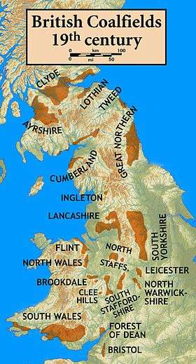
The Flintshire Coalfield in north-east Wales is one of the smaller British coalfields. It extends from the Point of Ayr in the north, along the Dee Estuary through Connah's Quay to Caergwrle in the south.[1] A small part extends onto the Wirral i.e. English coast of the estuary at Neston which was the site of a coalmine for a period. The coal-bearing strata continue southwards of Caergwrle as the Denbighshire Coalfield. Together the two coalfields are known as the North Wales Coalfield.[2]
Geology
Several coal seams are named in the sequence. Some seams are absent in the northern part of the coalfield and are labelled as (S) whilst the others occur across the coalfield as a whole. The Chwarelau Seam which appears only in the north actually occurs within the underlying Millstone Grit sequence rather than the Coal Measures proper. The seams are listed stratigraphically with the uppermost (youngest) at the head of the list and the lowermost (oldest) at the foot.[3] [4]Local names are shown in brackets.
- Within the Pennine Middle Coal Measures Formation:
- Upper Main (S)
- Pontybodkin Mountain (S)
- Tryddyn Half-Yard (S)
- Drowsell (Massey)
- Powell (Bind)(Bi)
- Hollin (Cannel)(H)
- Crank (Three Quarter)(C)(S)
- Quaker (Brassey) (B)(S)
- Black Bed (Rough)(R)
- Main (Five Yard)(M)
- Lower Bench (Three Yard)(LB)
- Crown (Mostyn Two Yard)(Diamond)
- Within the Pennine Lower Coal Measures Formation:
- Upper Red (Durdog)(King)(K)
- Lower Red (Yard)(Cannel)(C)
- Cannel (Stone)
- Stone (divides into Wall (W) and Bench (BC)in south)(Hard Five Quarter)
- Nant (Badger)(N)
- Ruabon Yard (Yard)(Soft Five Quarter)(Y)
- Premier (Bychton Two Yard)(P)
- Llwyneinion Half Yard (Picton Three Quarter)
- Within the Gwespyr Sandstone Formation of the Millstone Grit Group:
- Chwarelau (N) (Little Coal)
References
- ↑ British Geological Survey, 2007 Bedrock Geology: UK South, 1:625,000 scale geological map (5th edn), BGS, Keyworth, Notts
- ↑ http://northwalesminers.com/geology.htm
- ↑ British Geological Survey 1:50,000 geological map sheets nos 96 Liverpool and 108 Flint, BGS, Keyworth, Notts
- ↑ British Geological Survey 1:10,000 geological map sheet SJ26NE, BGS, Keyworth, Notts
Coordinates: 53°12′39″N 3°07′24″W / 53.2108°N 3.1232°W