Florida State Road 48
| ||||
|---|---|---|---|---|
| Route information | ||||
| Maintained by FDOT | ||||
| Length: | 2.167 mi[1] (3.487 km) | |||
| Major junctions | ||||
| West end: |
| |||
| East end: |
| |||
| Highway system | ||||
| ||||

State Road 48 (SR 48) is a short east–west state highway in Bushnell, Florida. It runs from Interstate 75 (I-75) at exit 314 to U.S. Highway 301 (US 301). Segments formerly a part of the state road are now designated County Road 48 (CR 48) where they are under county maintenance.
History
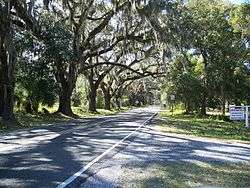
Previously, SR 48 was much longer than it is today. It originally ran from US 41 in Floral City, in Citrus County. Within Floral City itself, it is called East Orange Avenue, while east of the city it is known as East Bushnell Road. After crossing the Withlacoochee River it wound through western Sumter County along part of the DeSoto Trail before reaching Bushnell.
In the early 21st century, FDOT widened SR 48 to four lanes between east of CR 317 and Interstate 75 and made other improvements in front of a Walmart Supercenter. The widening did not lead to a re-extension of the state designation, though, and road remains two lanes wide both under I-75 and into downtown Bushnell until in intersects CR 475 and CR 548. From there it turns south as a four-lane boulevard before intersecting with US 301.
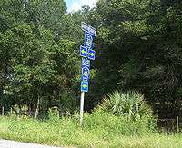
Returning to its county road status, the former SR 48 runs concurrently with US 301 along East Noble Road, then with CR 476 along North Florida Street and South Florida Street, until it reaches East Seminole Avenue, and turns east before leaving Bushnell's city limits, and heads through the rest of rural Sumter County. North of the city of Webster it intersects with SR 471 as it heads towards Center Hill.
Northeast of Center Hill, SR 48 crossed the Sumter–Lake county line and was named Leesburg Highway. In Okahumpka, the road runs concurrently with CR 33, then turned at 1st Street, taking the designation from CR 470 on its way to SR 19 in Howey-in-the-Hills. Former sections are now designated CR 48 in Citrus, Sumter and Lake counties.
Major intersections
| County | Location | mi[1][2] | km | Destinations | Notes |
|---|---|---|---|---|---|
| Citrus | Floral City | 0.000 | 0.000 | ||
| | 1.7[3] | 2.7 | |||
| | 2.1[3] | 3.4 | |||
| Withlacoochee River | 4.0 | 6.4 | Bridge | ||
| Sumter | | 4.6[3] | 7.4 | ||
| | 12.116 | 19.499 | west end of state maintenance | ||
| | 12.17 | 19.59 | I-75 exit 314 | ||
| Bushnell | 14.030 | 22.579 | west end of SR 475 overlap | ||
| 14.283 | 22.986 | east end of SR 475 overlap; west end of US 301 / SR 35 overlap; east end of SR 48 (becomes CR 48) | |||
| 14.816 | 23.844 | east end of US 301 / SR 35 overlap (and of state maintenance); west end of CR 476 overlap | |||
| 15.1[3] | 24.3 | east end of CR 476 overlap | |||
| Bevilles Corner | 18.7[3] | 30.1 | |||
| Center Hill | 22.2[3] | 35.7 | |||
| 22.5[3] | 36.2 | ||||
| Lake | Leesburg | 31.2[3] | 50.2 | west end of CR 33 overlap | |
| Okahumpka | 31.7[3] | 51.0 | east end of CR 33 overlap | ||
| Leesburg | 32.8[3] | 52.8 | |||
| Howey-in-the-Hills | 39.8[3] | 64.1 | |||
1.000 mi = 1.609 km; 1.000 km = 0.621 mi
| |||||
References
External links
| Wikimedia Commons has media related to Florida State and County Roads 48. |