Four Craters Lava Field
| Four Craters Lava Field | |
|---|---|
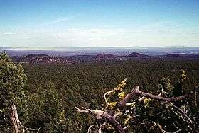 Craters of the aptly named Four Craters Lava Field are seen here from the NW on Green Mountain. | |
| Highest point | |
| Elevation | 4,924 ft (1,501 m) [1] |
| Coordinates | 43°21′36″N 120°39′46″W / 43.360009°N 120.66267°WCoordinates: 43°21′36″N 120°39′46″W / 43.360009°N 120.66267°W [2] |
| Geography | |
| Location | Lake County, Oregon, U.S. |
| Geology | |
| Age of rock | Pleistocene[1] |
| Mountain type | volcanic field |
| Last eruption | < 50,000 years ago[3] |
Four Craters Lava Field is a basaltic volcanic field located south east of Newberry Caldera in the U.S. state of Oregon.[1] The volcanic field covers about 30 square kilometers. Four Pleistocene cinder cones are the source of the flows in the field and are aligned along a fissure trending N 30° W. The cones rise 75 to 120 meters above the flows and the distance between the northern most and southern most cones is about 3.5 kilometers.[3]
Closely related to the Four Craters lava field is Crack-in-the-Ground located at the southwest corner of the field. The eruptions from the field were accompanied by a slight sinking of the older rock surface. This shallow, graben-like sink is about 3 kilometers wide and extends to the south into an old lake basin. Crack-in-the-Ground marks the western edge of this small, volcano-tectonic depression and is nearly 9 meters deep and over a meter wide. The crack is the result of a tension fracture along a hingeline produced by the drapping of Green Mountain lava flows over the edge of upthrown side of the concealed fault zone.[3]
References
![]() This article incorporates public domain material from the United States Forest Service document "Deschutes & Ochoco National Forests - Crooked River National Grassland".
(archived)
This article incorporates public domain material from the United States Forest Service document "Deschutes & Ochoco National Forests - Crooked River National Grassland".
(archived)
- 1 2 3 "Four Craters Lava Field". Global Volcanism Program. Smithsonian Institution. Retrieved 2008-05-12.
- ↑ "Four Craters Lava Field". Geographic Names Information System. United States Geological Survey. Retrieved 2014-12-29.
- 1 2 3 "Oregon Volcanoes - Four Craters Flows". Deschutes & Ochoco National Forests - Crooked River National Grassland. United States Forest Service. 2003-12-24. Archived from the original on 2010-11-09. Retrieved 2008-05-12.
Further reading
- Peterson, Norman V.; Edward A. Groh (September 1964). "Crack-In-The-Ground, Lake County, Oregon" (PDF). The Ore Bin. Portland, Oregon: State Of Oregon - Department of Geology and Mineral Industries. 26 (9): 158–166. Retrieved 2008-08-21.
- Peterson, Norman V.; Edward A. Groh (March 1963). "Recent Volcanic Landforms In Central Oregon" (PDF). The Ore Bin. Portland, Oregon: State Of Oregon - Department of Geology and Mineral Industries. 25 (3): 33–45. Retrieved 2008-08-21.