Fourth of July Peak (Custer County, Idaho)
| Fourth of July Peak | |
|---|---|
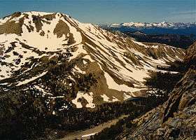 Fourth of July Peak at left | |
| Highest point | |
| Elevation | 10,713 ft (3,265 m) |
| Prominence | 1,133 ft (345 m) [1] |
| Parent peak | Castle Peak |
| Coordinates | 44°01′48″N 114°38′06″W / 44.0301°N 114.635°WCoordinates: 44°01′48″N 114°38′06″W / 44.0301°N 114.635°W |
| Geography | |
 Fourth of July Peak Custer County, Idaho, U.S. | |
| Parent range | White Cloud Mountains |
| Topo map | USGS Washington Peak |
| Climbing | |
| Easiest route | Simple scrambling, class 2 |
Fourth of July Peak at 10,713 feet (3,265 m) above sea level is a peak in the White Cloud Mountains of Idaho. The peak is located in Sawtooth National Recreation Area in Custer County 2.54 mi (4.09 km) from Castle Peak, its line parent. It is the 201st highest peak in Idaho and rises to the west of Fourth of July and Washington lakes.[2][3]
References
- ↑ "Fourth of July Peak". Lists of John. Retrieved January 12, 2013.
- ↑ Sawtooth National Forest (Map) (1998 ed.). Sawtooth National Forest, U.S. Forest Service.
- ↑ "Fourth of July Peak". SummitPost.org. Retrieved January 12, 2013.
This article is issued from Wikipedia - version of the 2/25/2016. The text is available under the Creative Commons Attribution/Share Alike but additional terms may apply for the media files.