Fox's Gap
| Fox's Gap | |
|---|---|
|
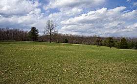
Fox's Gap looking northeast towards Turner's Gap | |
| Elevation | 1,060 ft (323 m) |
| Location | Maryland, United States |
| Range |
Blue Ridge Mountains South Mountain |
| Coordinates | 39°28′15″N 77°37′02″W / 39.47083°N 77.61722°WCoordinates: 39°28′15″N 77°37′02″W / 39.47083°N 77.61722°W |
 Fox's Gap | |
Fox's Gap, also known as Fox Gap, is a wind gap in the South Mountain Range of the Blue Ridge Mountains, located in Frederick County and Washington County, Maryland. The gap is traversed by Reno Monument Road. The Appalachian Trail also crosses the gap.
Geography
The gap is about 200 feet (61 m) below the ridge line to the north, 400 feet (120 m) below the ridge line to the south and about 400 feet (120 m) above the surrounding lowlands. To the east of the gap lies the Middletown Valley and to the west the Hagerstown Valley. Turner's Gap is 1 mile (1.6 km) to the north, while Lambs Knoll is immediately to the south.
History
The area was settled in early 1751 by the John and Christiana Fox family and their son Frederick, German immigrants from Hesse. Frederick assembled adjoining lands which eventually extended to Turner's Gap. The area is first mentioned as "Foxes Gap" in a September 10, 1792 letter. Frederick Fox moved to Ohio in the early 1800s after the death of his wife.[1]
The Daniel Wise family bought a portion of the property in 1858 for $46.96, clearing fields and building a log cabin. The Wise House was demolished in 1919. On September 14, 1862 the area was the scene some of the heaviest engagements of the Battle of South Mountain. The Reno Monument erected in 1889 by fellow soldiers at the top of Fox's Gap along Reno Monument Road commemorates the death of Union general Jesse L. Reno.[1] Another monument has been erected nearby in the 1990s, which commemorates also the death of Confederate Brig. General Samuel Garland, Jr. and about a half-mile south is a bronze sculpture on a granite stone base dedicated in 2005 to remember the North Carolina troops that held the line here.
The area is listed on the National Register of Historic Places as part of the Turner's and Fox's Gaps Historic District.[2]
References
- 1 2 "History of Fox Gap, Maryland". A Gap in Time: The Wise Farmstead/Fox Gap Archaeological Project. Archeological Services Program, Indiana University of Pennsylvania. Retrieved 1 April 2011.
- ↑ National Park Service (2008-04-15). "National Register Information System". National Register of Historic Places. National Park Service.