Fröndenberg
| Fröndenberg | ||
|---|---|---|
| ||
 Fröndenberg | ||
| Coordinates: 51°28′19″N 7°45′57″E / 51.47194°N 7.76583°ECoordinates: 51°28′19″N 7°45′57″E / 51.47194°N 7.76583°E | ||
| Country | Germany | |
| State | North Rhine-Westphalia | |
| Admin. region | Arnsberg | |
| District | Unna | |
| Government | ||
| • Mayor | Egon Krause (SPD) | |
| Area | ||
| • Total | 56.21 km2 (21.70 sq mi) | |
| Population (2015-12-31)[1] | ||
| • Total | 20,961 | |
| • Density | 370/km2 (970/sq mi) | |
| Time zone | CET/CEST (UTC+1/+2) | |
| Postal codes | 58730 | |
| Dialling codes | 02373, 02303, 02377, 02378 | |
| Vehicle registration | UN | |
| Website | www.froendenberg.de | |
_COA.svg.png)
Fröndenberg (German pronunciation: [ˈfʁœndənbɛʁk]) is a town in the district of Unna, in North Rhine-Westphalia, Germany.
Geography
Fröndenberg is situated in the Ruhr valley, approx. 10 km south-east of the district capital Unna, near the Hönne.
Neighbouring places
International relations
Fröndenberg is twinned with:=
History
The city as such is relatively new, it grew out of the reorganization in 1902 whereby the former independent villages Stift, Westick and village Froendenberg melted into the bigger village community of Fröndenberg. It obtained city status in 1952. The oldest record of the name `Frundeberg` is the papal document by Coelestin III from 1197.
The present day administrative infrastructure goes back to 1968 when the villages Altendorf, Ardey, Bausenhagen, Dellwig, Frohnhausen, Frömern, Langschede, Neimen, Ostbüren, Stentrop, Strickherdicke, the town of Warmen and the town of Fröndenberg were merged into one administrative unit. In 1969 the village Bentrop also became part of the Fröndenberg district.
Personalities
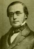
- Ernst Wilhelm Hengstenberg (1802-1869), Protestant theologian and churchman
- Arthur Jonath (1909-1963), athlete (sprinter)
- Bishop Franz-Josef Bode (born 1951), 1986-1991 Catholic pastor in St. Marien
- Thomas Lehn (born 1958), musician
- David Wilms (born 1963), television host
- David Blacha (born 1990), football midfielder
References
- ↑ "Amtliche Bevölkerungszahlen". Landesbetrieb Information und Technik NRW (in German). 18 July 2016.
- Sources
- History of Fröndenberg (German)
External links
- Official site (German)
| Wikimedia Commons has media related to Fröndenberg. |
Towns and municipalities in Unna (district) | ||
|---|---|---|