Fraser Pass
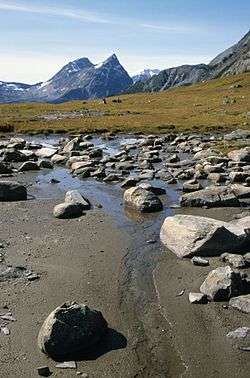
Fraser Pass is a mountain pass in British Columbia's Rockies. Its summit is 2,015 metres above sea level. Although immediately adjacent to the Continental Divide, the pass does not cross it; rather, it bridges the drainage basins of the Fraser River and Columbia River, both Pacific-draining rivers.[1]
The pass is drained to the north by the Fraser River. A dripping spring just west of a pond at Fraser Pass is the source of British Columbia's longest river. The south side of the pass is drained by Hugh Allan Creek; it flows into Canoe Reach, the north arm of Kinbasket Lake which is the reservoir behind Mica Dam on the Columbia River. [2]
Fraser Pass is difficult to reach. Access by foot requires about 40 km (25 mi) of bush-whacking from the Yellowhead Highway near Lucerne Campground. The most feasible access is by a 25-minute helicopter flight from Valemount. Beautiful British Columbia Magazine first identified the source of the Fraser River during an expedition to Fraser Pass in 1985. [3] Group tours by helicopter to the source of the Fraser are offered every few years by Wells Gray Tours.
See also
References
- ↑ "Fraser Pass". BC Geographical Names.
- ↑ "Fraser Pass" entry on Bivouac.com - Canadian Mountain Encyclopedia
- ↑ McGill, Bryan and Poon, Linda editors (1986). The Fraser River, British Columbia, Canada. A special publication of Beautiful British Columbia magazine. ISBN 0-7718-8373-0
Coordinates: 52°31′00″N 118°18′07″W / 52.51667°N 118.30194°W