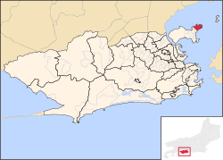
Freguesia (Ilha do Governador)
Not to be confused with Freguesia (Jacarepaguá).
| Freguesia | |
|---|---|
| Neighborhood | |
 | |
| Coordinates: 22°47′17″S 43°10′21″W / 22.78806°S 43.17250°WCoordinates: 22°47′17″S 43°10′21″W / 22.78806°S 43.17250°W | |
| Country |
|
| State | Rio de Janeiro (RJ) |
| Municipality/City | Rio de Janeiro |
| Zone | North Zone |
| Administrative Region | Ilha do Governador[1] |
| Area | |
| • Total | 405.64 ha (1,002.36 acres) |
| Population (2010) | |
| • Total | 19,437 |
| • Density | 4,800/km2 (12,000/sq mi) |
Freguesia (Ilha do Governador) is a neighborhood in the North Zone of Rio de Janeiro, Brazil.[2]
References
- ↑ "RA XX - Ilha do Governador". Prefeitura da Cidade do Rio de Janeiro. Retrieved 4 October 2014.
- ↑ "Bairro: Freguesia (Ilha do Governador)". Prefeitura da Cidade do Rio de Janeiro. Retrieved 4 October 2014.
This article is issued from Wikipedia - version of the 1/11/2015. The text is available under the Creative Commons Attribution/Share Alike but additional terms may apply for the media files.