Friden, Derbyshire
| Friden | |
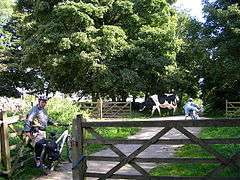 High Peak Trail at Friden. |
|
 Friden |
|
| OS grid reference | SK166603 |
|---|---|
| District | Derbyshire Dales |
| Shire county | Derbyshire |
| Region | East Midlands |
| Country | England |
| Sovereign state | United Kingdom |
| Post town | BUXTON |
| Postcode district | SK17 |
| Police | Derbyshire |
| Fire | Derbyshire |
| Ambulance | East Midlands |
| EU Parliament | East Midlands |
|
|
Coordinates: 53°08′24″N 1°45′07″W / 53.140°N 1.752°W
Friden is a hamlet in the civil parish of Hartington Nether Quarter, Derbyshire, England. It is located 11 miles south-east of Buxton just off the Newhaven to Cromford Via Gellia road and lies within the Peak District National Park.
The name "Friden" is derived from the goddess Frig, the wife of Woden.[1] It is on the route of the former Cromford and High Peak Railway, which now forms the High Peak Trail.[2] Friden Grange is a Grade II listed building.[3][4] It is notable for the manufacture of refractory products.[5]
See also
References
- ↑ Davidson, Hilda Ellis. Roles of the northern goddess
- ↑ High Peak & Tissington Trails, Peak District National Park Authority website
- ↑ Friden Grange at British Listed Buildings website
- ↑ Friden Grange at Images of England website
- ↑ DSF Refractories & Minerals,Company Website
External links
![]() Media related to Friden, Derbyshire at Wikimedia Commons
Media related to Friden, Derbyshire at Wikimedia Commons
This article is issued from Wikipedia - version of the 10/11/2016. The text is available under the Creative Commons Attribution/Share Alike but additional terms may apply for the media files.