Galisteo Dam
| Galisteo Dam | |
|---|---|
|
Galisteo Dam | |
 Location of Galisteo Dam in New Mexico | |
| Country | United States |
| Location | Santa Fe County, New Mexico |
| Coordinates | 35°27′50″N 106°12′33″W / 35.463816°N 106.20917°WCoordinates: 35°27′50″N 106°12′33″W / 35.463816°N 106.20917°W |
| Purpose | Flood control |
| Opening date | 1970 |
| Owner(s) | United States Army Corps of Engineers |
| Dam and spillways | |
| Height | 164 feet (50 m) |
| Length | 2,820 feet (860 m) |
| Reservoir | |
| Total capacity | 152,600 acre-feet |
Galisteo Dam (National ID # NM00002) is a dam in Santa Fe County, New Mexico.
The earthen dam was constructed in 1970 by the United States Army Corps of Engineers with a height of 164 feet and 2820 feet long at its crest.[1] Built solely for flood control and sediment impoundment on Galisteo Creek, with its "long history of violent floods",[2] the main line of the Atchison, Topeka and Santa Fe railroad was relocated to accommodate the project.[3] The dam is owned and operated by the Corps of Engineers.
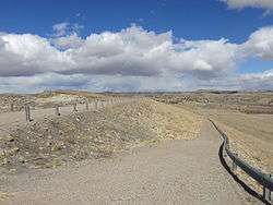
The reservoir it creates, Galisteo Reservoir, is ordinarily dry. Its maximum capacity is 152,600 acre-feet.[1] No water recreation is available. Although the approximately five-acre site is open to the public for day use, the site is surrounded by private lands and lands of the Kewa Pueblo.[4]
References
- 1 2 "Galisteo Dam". Findlakes.com. Retrieved September 29, 2013.
- ↑ "New Mexico - State Parks Division". Emnrd.state.nm.us. April 1, 2013. Retrieved September 29, 2013.
- ↑ "Waldo to Rosario". Abandoned Rails. November 23, 2012. Retrieved September 29, 2013.
- ↑ "Galisteo Dam Day Use Recreation Area". U.S. Army Corps of Engineers. Retrieved September 27, 2013.