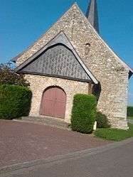
Garencières
| Garencières | ||
|---|---|---|
 | ||
| ||
 Garencières | ||
|
Location within Normandy region  Garencières | ||
| Coordinates: 48°57′28″N 1°15′58″E / 48.9578°N 1.2661°ECoordinates: 48°57′28″N 1°15′58″E / 48.9578°N 1.2661°E | ||
| Country | France | |
| Region | Normandy | |
| Department | Eure | |
| Arrondissement | Évreux | |
| Canton | Saint-André-de-l'Eure | |
| Government | ||
| • Mayor (2008–2014) | Gerard Fauchet | |
| Area1 | 6.87 km2 (2.65 sq mi) | |
| Population (2008)2 | 554 | |
| • Density | 81/km2 (210/sq mi) | |
| Time zone | CET (UTC+1) | |
| • Summer (DST) | CEST (UTC+2) | |
| INSEE/Postal code | 27277 / 27220 | |
| Elevation |
134–150 m (440–492 ft) (avg. 152 m or 499 ft) | |
|
1 French Land Register data, which excludes lakes, ponds, glaciers > 1 km² (0.386 sq mi or 247 acres) and river estuaries. 2 Population without double counting: residents of multiple communes (e.g., students and military personnel) only counted once. | ||

Garencières is a former commune in the Eure department in northern France. On 1 January 2016, it was merged into the new commune of La Baronnie.[1]
Population
| Historical population | ||
|---|---|---|
| Year | Pop. | ±% |
| 1962 | 117 | — |
| 1968 | 153 | +30.8% |
| 1975 | 212 | +38.6% |
| 1982 | 325 | +53.3% |
| 1990 | 487 | +49.8% |
| 1999 | 495 | +1.6% |
| 2008 | 554 | +11.9% |
See also
References
- ↑ Arrêté préfectoral 17 December 2015 (French)
| Wikimedia Commons has media related to Garencières. |
This article is issued from Wikipedia - version of the 3/24/2016. The text is available under the Creative Commons Attribution/Share Alike but additional terms may apply for the media files.