Georgia State Route 93
| ||||
|---|---|---|---|---|
|
Georgia State Route 93 highlighted in red | ||||
| Route information | ||||
| Maintained by GDOT | ||||
| Length: | 60.9 mi[1] (98.0 km) | |||
| Major junctions | ||||
| South end: |
| |||
|
| ||||
| North end: |
| |||
| Location | ||||
| Counties: | Grady, Mitchell | |||
| Highway system | ||||
| ||||

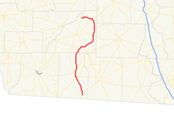
State Route 93 (SR 93) is a strange-shaped state highway in the southwest part of the U.S. state of Georgia. The highway runs 60.9 miles (98.0 km) from Moncrief north to Pelham, northeast to Hinsonton, north to Lester, and west to Baconton.
Route description
Grady County
SR 93 begins at an intersection with US 319/SR 35 in Moncrief. The route heads northwest to Cairo. It heads into the city on 5th Street SE. At its intersection with SR 188,it turns left onto 4th Avenue SE. At its intersection with SR 111, the two routes turn north onto South Broad Street as a concurrency. Just north, the two routes intersect SR 38 Spur. A little farther north, US 84/SR 38 crosses the concurrency. Northeast of Cairo, the concurrency ends with SR 111 departing to the northeast, while SR 93 heads to the north, through rural areas of the county.
Mitchell County
Just southwest of Pelham, SR 93 turns to the northeast and intersects SR 262. In Pelham, SR 65, intersects the route. Just prior to leaving the town is the first intersection with US 19/SR 3/SR 300. In the town of Hinsonton, the route turns to the north. Southeast of Pebble City is an intersection with SR 37. A short distance later, SR 270 intersects the route in Sale City. In Lester, the route has a brief concurrency with SR 112. In Lester, the route turns to the west to meet its northern terminus, the second intersection with US 19/SR 3/SR 300 in Baconton. There, the roadway continues as Lester Road NE.[1]
Major intersections
| County | Location | mi[1] | km | Destinations | Notes |
|---|---|---|---|---|---|
| Grady | Moncrief | 0.0 | 0.0 | Southern terminus | |
| Cairo | 12.0 | 19.3 | |||
| 12.4 | 20.0 | Southern end of SR 111 concurrency | |||
| 12.8 | 20.6 | ||||
| 13.4 | 21.6 | Southern end of US 84/SR 38 concurrency | |||
| 13.4 | 21.6 | Northern end of US 84/SR 38 concurrency | |||
| | 17.2 | 27.7 | Northern end of SR 111 concurrency | ||
| Mitchell | | 29.8 | 48.0 | ||
| Pelham | 31.5 | 50.7 | |||
| 32.5 | 52.3 | ||||
| | 43.7 | 70.3 | |||
| Sale City | 46.1 | 74.2 | |||
| Lester | 54.1 | 87.1 | Southern end of SR 112 concurrency | ||
| 54.5 | 87.7 | Northern end of SR 112 concurrency | |||
| Baconton | 60.9 | 98.0 | Northern terminus | ||
1.000 mi = 1.609 km; 1.000 km = 0.621 mi
| |||||
See also
-
.svg.png) Georgia (U.S. state) portal
Georgia (U.S. state) portal -
 U.S. Roads portal
References
- 1 2 3 Google (October 19, 2012). "Route of SR 93" (Map). Google Maps. Google. Retrieved October 19, 2012.
External links
![]() Media related to Georgia State Route 93 at Wikimedia Commons
Media related to Georgia State Route 93 at Wikimedia Commons