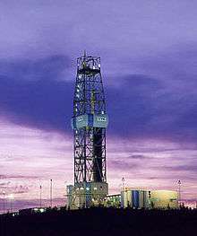
German Continental Deep Drilling Programme

The German Continental Deep Drilling Programme (in German: Kontinentales Tiefbohrprogramm der Bundesrepublik Deutschland[1]), abbreviated as the KTB borehole, was a scientific drilling project carried out from 1987 to 1995 near Windischeschenbach, Bavaria. The main superdeep borehole reached a depth of 9,101 metres in the Earth's continental crust.
The German Federal Ministry of Research funded the project with 528 million DM (270 million Euro). The Lower Saxony LBEG mining office (Landesamt für Bergbau, Energie und Geologie) took over the project lead. After the drilling project had ended the GFZ German Research Centre for Geosciences used the borehole to install a seismic observatory at depth (Tiefenobservatorium) that was active from 1996 to 2001. The derrick - one of the largest in the world - became a tourist attraction in the region. The two boreholes remain open for further scientific use.
History
The site of the drilling project is in the ZEV, Zone von Erbendorf-Vohenstrauß, just south of the Erbendorflinie being the contact zone where Laurasia and Gondwana merged into Pangaea. Due to the geological genesis the earth crust consists of a number of layers exhibiting a number of phenomena such as strong magnetic areas and the Erbendorfkörper, a large mass drifting at about eleven kilometres below the surface with a relative high speed and seismic activity.
The project started in September 1987 with an advance borehole using state of the art technology. The borehole reached its target depth of 4,000 metres in April 1989. The results of this drilling were used as parameters for the main borehole - for example the temperature gradient was higher than originally expected. The main drilling started on 8 September 1990 about 200 metres away from the advance borehole for an envisaged depth of 10,000 metres. The first 7,500 metres were using an automatic vertical drill head so that the lateral deviation could be limited to 12 metres. Due to the expected failure of the electronics below that depth a conventional drill head was used below that point. Due to brittleness and ductility the borehole was deforming multiple times, requiring to backfill the hole and start drilling again from a higher place. These operations continued for the last year of the project - the timing and budget constraints put an end to the efforts to go deeper. The drilling ended on 12 October 1994 after 1,468 days at a depth of 9,101 metres and about 300 metres lateral deviation showing a temperature of 265 °C. The planned three main experiments were performed until 31 December 1994. The facilities were being partially dismantled until 31 December 1995.
Results
The KTB project contained a lot of innovations - the Kola drilling experiment had shown problems with high friction that was increased by the vertical instability. So the German scientists designed a new drill head that would keep the direction with minimal lateral difference. The drill head was also designed to withstand temperatures between 250 and 300 °C. The original expectations had been that this temperature would be reached at a depth about 10 to 14 km. This is also the reason that the ZEV place was chosen - there was another location in the Black Forest that had been considered equal in the scientific interest level but it was expected to have a higher temperature gradient. At the ZEV location however it was hoped to possibly reach the Erbendorfkörper - a mass that reflects seismic waves while the portion that enters it will be transmitted quickly.
While the Erbendorfkörper had not been reached the KTB drilling has been considered a success regardless. For one thing the temperature rose much more quickly than expected which inflicted a reform of the theories about the temperature gradient at very deep drillholes. Other theory changes were required as well - it had been expected that the large mass and tectonic pressures would change the nature of the rock at depth (so called metamorphic rock). Quite unexpectedly however the rock layers were not solid at that depth and instead large amounts of fluid and gas were met pouring into the drillhole. Due to the heat and fluids the rock was of a dynamic nature which changes the way that the next superdeep drilling would be planned.
The experiments of the KTB did also show new results. The initial seismic tests showed very different recordings compared to those near the surface so that the theories on the source of seismic reflections needed to change. Using the data the reflections from the deep can be interpreted better even when being initiated from the surface.
The first experiment, the "Dipol-Dipol-Experiment" was about measuring the electric conductibility around the drill hole. This showed lines of graphite spanning through the rock that would also allow the rocks to glide when pressures moves them. The second experiment was to put a high pressure into the drillhole such that the rock would start cracking, the "Integriertes Hydrafrac/Seismik Experiment". The resulting seismic activity was measured at multiple stations in the larger area - the result had been that the overall pressure came from the south, actually the African tectonic plate at work. The third experiment, the "Fluid/Hydraulik-Test" was pumping large amounts of fluid into the rock which showed it to be generally porous.[2]
The experiences were the foundation of the follow-up project, the International Continental Scientific Drilling Program (ICDP) founded in 1996. The German scientists of the KTB were also called to help with the San Andreas Fault Observatory at Depth drillhole.
References
- ↑ literally: "Continental deep-drilling programme of the Federal Republic of Germany"
- ↑ http://scinexx.de/dossier-detail-56-11.html
External links
| Wikimedia Commons has media related to KTB. |
- geological surface map around the drilling site (picture)
- geological cross section northwest-southeast (picture)
- geological cross section southwest-northeast (picture)
- GFZ Potsdam - ICDP successor project (English)
- GFZ Potsdam - photo material on the KTB
- additional information on the KTB (German)
- Main coordination centre of the KTB
Coordinates: 49°48′55″N 12°07′14″E / 49.81528°N 12.12056°E