Ghamubar Zom
| Ghamubar Zom | |
|---|---|
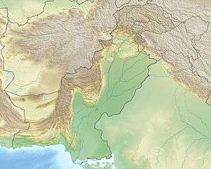 Ghamubar Zom Location in Pakistan | |
| Highest point | |
| Elevation | 6,518 m (21,385 ft) [1] |
| Prominence | 2,133 m (6,998 ft) [1] |
| Listing | Ultra |
| Coordinates | 36°35′24″N 73°20′30″E / 36.59000°N 73.34167°ECoordinates: 36°35′24″N 73°20′30″E / 36.59000°N 73.34167°E [1] |
| Geography | |
| Location | Gilgit–Baltistan, Pakistan |
| Parent range | Hindu Kush |
Ghamubar Zom is a mountain in the Hindu Raj mountain range of Asia. Located in Gilgit–Baltistan, Pakistan, it has a summit elevation of 6,518 m above sea level.[2] The mountain is close to the border of Gilgit–Baltistan and Khyber Pakhtunkhwa. The nearest village from the mountain is Darkot in Yasin valley.
The entire prominence of mountain is visible from Darkot and Rawat villages. Trekkers crossing the Darkot pass enjoys breathtaking views of the mountain.
See also
References
- 1 2 3 "The Karakoram, Pakistan Himalaya and India Himalaya (north of Nepal)". Peaklist.org. Retrieved 2015-02-16.
- ↑ "Ghamubar Zom, Pakistan". Peakbagger.com. Retrieved 2015-02-16.
This article is issued from Wikipedia - version of the 11/27/2016. The text is available under the Creative Commons Attribution/Share Alike but additional terms may apply for the media files.