Gleann Dubh
National grid reference NM97804230
| Gleann Dubh | |
|---|---|
 | |
| Location | Barcaldine, Scotland |
| Coordinates | 56°31′43″N 5°17′16″W / 56.5287°N 5.2878°WCoordinates: 56°31′43″N 5°17′16″W / 56.5287°N 5.2878°W |
| Type | Reservoir |
| Basin countries | Scotland, United Kingdom |
| Surface area | 166000 sq. metres |
| Surface elevation | 32 metres |
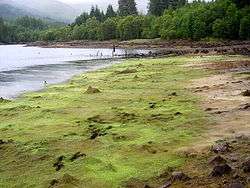
The reservoir (the "Black Glen") is an impounding reservoir located 9 kilometres north east of the Connel Bridge in Barcaldine Forest. The earthen dam is 23.4 metres high and was completed in 1984. The reservoir provides a supply of water for the hydroelectric scheme at the Marine Resource Centre in the village of Barcaldine.

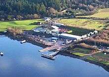
The Marine Resource Centre, Barcaldine
See also
Sources
- "Argyll and Bute Council Reservoirs Act 1975 Public Register"
- "The Forests of North Argyll" - The Forestry Commission
This article is issued from Wikipedia - version of the 10/10/2012. The text is available under the Creative Commons Attribution/Share Alike but additional terms may apply for the media files.