Glenbervie, New Zealand
| Glenbervie | |
|---|---|
|
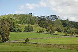
Stone walls near Glenbervie | |
 Glenbervie | |
| Coordinates: 35°40′32″S 174°20′59″E / 35.67556°S 174.34972°ECoordinates: 35°40′32″S 174°20′59″E / 35.67556°S 174.34972°E | |
| Country | New Zealand |
| Region | Northland Region |
| District | Whangarei District |
Glenbervie is a settlement in Northland, New Zealand. The city of Whangarei lies to the southwest, and the localities of Kiripaka and Ngunguru to the northeast. The Glenbervie Forest is north of the settlement.[1][2]
Education
Glenbervie School is a coeducational contributing primary (years 1–6) school with a decile rating of 7 and a roll of 231.[3] The school was established in 1893.[4]
Notes
- ↑ Peter Dowling (editor) (2004). Reed New Zealand Atlas. Reed Books. pp. map 8. ISBN 0-7900-0952-8.
- ↑ Roger Smith, GeographX (2005). The Geographic Atlas of New Zealand. Robbie Burton. pp. map 24. ISBN 1-877333-20-4.
- ↑ "Te Kete Ipurangi - Glenbervie School". Ministry of Education.
- ↑ "Information Booklet". Glenbervie School.
External links
This article is issued from Wikipedia - version of the 8/30/2015. The text is available under the Creative Commons Attribution/Share Alike but additional terms may apply for the media files.