Goodpaster River
| Goodpaster River | |
| River | |
| Country | United States |
|---|---|
| State | Alaska |
| Census Area | Southeast Fairbanks, Valdez–Cordova |
| Source | |
| - coordinates | 64°N 143°W / 64°N 143°W |
| Mouth | Tanana River |
| - location | Big Delta |
| - coordinates | 64°10′17″N 145°37′36″W / 64.17139°N 145.62667°WCoordinates: 64°10′17″N 145°37′36″W / 64.17139°N 145.62667°W |
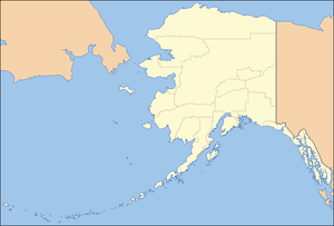 Location of the mouth of the Goodpaster River in Alaska
| |
The Goodpaster River is an 91-mile (146 km) major tributary of the Tanana River in the U.S. state of Alaska.[1] Its name in the Middle Tanana dialect of the Lower Tanana language is Jiiz Cheeg.[2] Goodpaster River is a stream located just 6.6 miles from Big Delta, in Southeast Fairbanks Census Area.[3]
The older glacial record in the Yukon-Tanana upland is found in the Goodpaster River Valley where records of at least three older glaciations are found, the oldes estimated to be Late Tertiary.[4]
The structure of the Goodpaster River Bridge consists of six 21-m simple spans.[5]
Naming
The stream was called Goodpaster River by Lieutenant Allen "in honor of the Goodpaster family of Kentucky." The two stream names were transposed by later map makers. Alternate names for this stream includes North Fork Goodpaster River and Volkmar River.[1]
Natives
The area of Goodpaster River and Big Delta, Delta River (incl. Delta Junction and Deltana) is homeland of the Delta-Goodpaster or Big Delta-Goodpaster band of the Middle Tanana of the Tanana Athabaskans. The Goodpaster River to be a natural break in the Tanana Athabaskan language area, separating upriver speakers of the Tanacross and Upper Tanana languages from the Lower (and Middle) Tanana speakers living farther downriver.[6][7]
Fishing
Catch and release king salmon fishing only from the mouth of the river to a marker located 25 miles upstream. The Goodpaster is accessible only by boat. Launch at the Tanana River near Delta Junction or Clearwater Lake).[8]
Mining
Only a few thousand ounces of gold from placer mines, and a few hundred ounces from lode gold mines were produced from the Goodpaster district before the discovery of Pogo. The district is east of the Fairbanks and south of the Circle district. The Pogo mine, located in the Goodpaster River Valley
See also
References
- 1 2 "Goodpaster River". Geographic Names Information System. United States Geological Survey. January 1, 2000. Retrieved October 25, 2014.
- ↑ UAF: Alaska Native Place Names
- ↑ http://www.hookandbullet.com/fishing-goodpaster-river-big-delta-ak/
- ↑ J. Ehlers and P.L. Gibbard (2004). Quaternary Glaciations - Extent and Chronology: Part II: North America. Elsevier.
- ↑ Goodpaster River Bridge
- ↑ Terry L. Haynes and William E. Simeone (2007). Upper Tanana ethnographic overview and assessment, Wrangell St. Elias National Park and Preserve. Alaska Department of Fish and Game, Division of Subsistence. Technical Paper Number 325.
- ↑ McKennan, Robert A. 1969. Athabascan grouping and social organization in Central Alaska. In Constributions to Anthropology: Band Societies. David Damas, ed. pp 93-114. National Museum of Canada bulletin 228. National Museum of Canada, Ottawa.
- ↑ www.adfg.alaska.gov: Roadside Salmon Fishing in Interior Alaska