Grade II* listed buildings in West Somerset

West Somerset shown within the county of Somerset

West Somerset is a local government district in the English county of Somerset. In the United Kingdom, the term listed building refers to a building or other structure officially designated as being of special architectural, historical or cultural significance; Grade II* structures are those considered to be "particularly significant buildings of more than local interest".[1] Listing was begun by a provision in the Town and Country Planning Act 1947. Once listed, severe restrictions are imposed on the modifications allowed to a building's structure or its fittings. In England, the authority for listing under the Planning (Listed Buildings and Conservation Areas) Act 1990[2] rests with Historic England, a non-departmental public body sponsored by the Department for Culture, Media and Sport; local authorities have a responsibility to regulate and enforce the planning regulations.

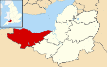
The district of West Somerset covers a largely rural area, with a population, according to the 2001 census, of 35,075[3] in an area of 740 square kilometres (290 sq mi).[4] The largest centres of population are the coastal towns of Minehead and Watchet. The council's administrative headquarters are in the village of Williton.

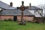
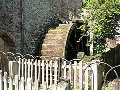
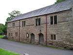
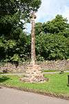
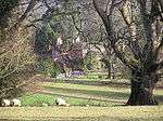
There are 100 Grade II* listed buildings in West Somerset.
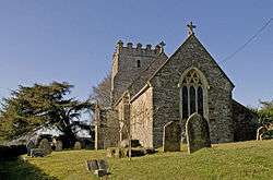
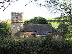
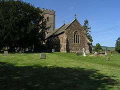
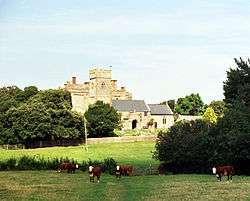
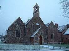
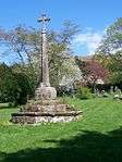
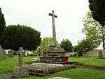
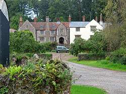
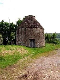
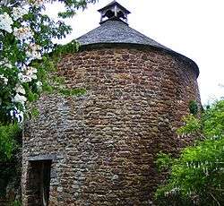
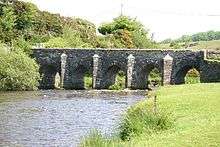
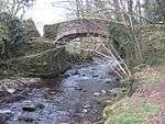
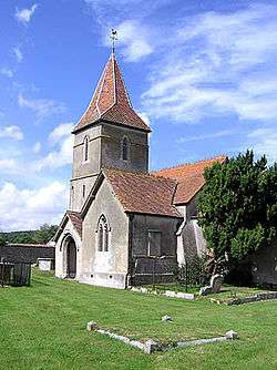
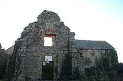
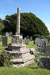
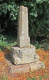
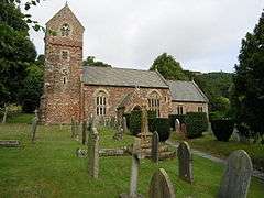
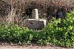
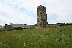
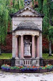
Buildings

Name Location Type Completed [note 1] Grid ref.[note 2]
Geo-coordinates
Entry number [note 3]ImageRef.
Allerford New Bridge Allerford Road Bridge Medieval SS8999046656
51°12′31″N 3°34′34″W / 51.208482°N 3.576219°W / 51.208482; -3.576219 (Allerford New Bridge)
1058050 [5]
Barn At South Entrance To Churchyard, Church Of St Mary Stogumber Tithe Barn 17th century ST0984337189
51°07′37″N 3°17′23″W / 51.12686°N 3.289725°W / 51.12686; -3.289725 (Barn At South Entrance To Churchyard, Church Of St Mary)
1345646
[6]
Binham Farmhouse Old Cleeve Farmhouse 16th century ST0353942446
51°10′23″N 3°22′52″W / 51.173089°N 3.381192°W / 51.173089; -3.381192 (Binham Farmhouse)
1345628
[7]
Bury Bridge Brompton Regis Trackway Medieval SS9446627456
51°02′12″N 3°30′24″W / 51.036741°N 3.506541°W / 51.036741; -3.506541 (Bury Bridge)
1263985
[8]
Butter Cross Dunster Wayside Cross Late C14/Early 15th century SS9881243873
51°11′06″N 3°26′57″W / 51.185099°N 3.449189°W / 51.185099; -3.449189 (Butter Cross)
1345602
[9]
Castle Mill and attached gateway and gate Dunster Gate Late 17th century SS9911243337
51°10′49″N 3°26′41″W / 51.180334°N 3.444747°W / 51.180334; -3.444747 (Castle Mill and attached gateway and gate)
1173447
[10]
Causeway Bridge at east entrance to Stogursey Castle Stogursey House 14th century ST2031342589
51°10′37″N 3°08′29″W / 51.176962°N 3.141339°W / 51.176962; -3.141339 (Causeway Bridge at east entrance to Stogursey Castle)
1295315
[11]
Chapel Cleeve Hotel Old Cleeve Country House 1818-23 ST0355542989
51°10′41″N 3°22′52″W / 51.177973°N 3.381109°W / 51.177973; -3.381109 (Chapel Cleeve Hotel)
1057541
[12]
Chapel of St Leonard Tivington School Prior To 1896 SS9332145045
51°11′41″N 3°31′41″W / 51.194634°N 3.528074°W / 51.194634; -3.528074 (Chapel of St Leonard)
1345394
[13]
Chargot House Luxborough House 1826 SS9802737145
51°07′28″N 3°27′31″W / 51.124481°N 3.458508°W / 51.124481; -3.458508 (Chargot House)
1057339
[14]
Church House and pound adjoining to the North West Crowcombe Gate 1515 ST1403336678
51°07′22″N 3°13′47″W / 51.122911°N 3.229743°W / 51.122911; -3.229743 (Church House and pound adjoining to the North West)
1057446
[15]
Church of All Saints Dulverton Parish Church 15th century SS9146028003
51°02′28″N 3°32′58″W / 51.041097°N 3.549562°W / 51.041097; -3.549562 (Church of All Saints)
1247824
[16]
Church of Saint Mary Kilve Parish Church 14th century ST1467143942
51°11′18″N 3°13′20″W / 51.18831°N 3.222353°W / 51.18831; -3.222353 (Church of Saint Mary)
1345709
[17]
Church of St Andrew Minehead Church 1877-1880 SS9678046148
51°12′19″N 3°28′44″W / 51.205185°N 3.478907°W / 51.205185; -3.478907 (Church of St Andrew)
1207013
[18]
Church of St Andrew Withypool Parish Church Late medieval SS8462835595
51°06′29″N 3°38′58″W / 51.108004°N 3.649395°W / 51.108004; -3.649395 (Church of St Andrew)
1057968
[19]
Church of St Bartholomew Rodhuish Chapel of Ease 15th century ST0121539594
51°08′49″N 3°24′49″W / 51.147055°N 3.413641°W / 51.147055; -3.413641 (Church of St Bartholomew)
1175299
[20]
Church of St Ethel Dreda West Quantoxhead Parish Church 1854-6 ST1132342006
51°10′13″N 3°16′11″W / 51.170395°N 3.269769°W / 51.170395; -3.269769 (Church of St Ethel Dreda)
1175935
[21]
Church of St George Sampford Brett Parish Church c. 1300 ST0894840199
51°09′14″N 3°18′12″W / 51.153777°N 3.303273°W / 51.153777; -3.303273 (Church of St George)
1295828
[22]
Church of St Giles Hawkridge Parish Church Norman SS8611230649
51°03′50″N 3°37′36″W / 51.063844°N 3.626645°W / 51.063844; -3.626645 (Church of St Giles)
1174221
[23]
Church of St John Cutcombe Parish Church 13th and early 14th century SS9310239236
51°08′33″N 3°31′46″W / 51.142377°N 3.529478°W / 51.142377; -3.529478 (Church of St John)
1174575
[24]
Church of St John Skilgate Parish Church 14th century SS9868927235
51°02′08″N 3°26′47″W / 51.035515°N 3.44627°W / 51.035515; -3.44627 (Church of St John)
1248077
[25]
Church Of St Martin Elworthy Parish Church 13th century ST0828934964
51°06′24″N 3°18′41″W / 51.106611°N 3.311359°W / 51.106611; -3.311359 (Church Of St Martin)
1057601
[26]
Church Of St Mary Brompton Ralph Parish Church 15th century ST0850432347
51°04′59″N 3°18′27″W / 51.083119°N 3.307625°W / 51.083119; -3.307625 (Church Of St Mary)
1057972
[27]
Church Of St Mary Brompton Regis Parish Church 13th century SS9513931488
51°04′23″N 3°29′53″W / 51.073108°N 3.498116°W / 51.073108; -3.498116 (Church Of St Mary)
1057978
[28]
Church of St Mary East Quantoxhead Parish Church 14th century ST1364143656
51°11′08″N 3°14′13″W / 51.185584°N 3.237019°W / 51.185584; -3.237019 (Church of St Mary)
1057410
[29]
Church of St Mary Oare Parish Church 15th century SS8020747311
51°12′45″N 3°42′59″W / 51.212399°N 3.716421°W / 51.212399; -3.716421 (Church of St Mary)
1345381
[30]
Church of St Mary Magdalene Withiel Florey Parish Church 12th century SS9868933280
51°05′23″N 3°26′53″W / 51.089855°N 3.447965°W / 51.089855; -3.447965 (Church of St Mary Magdalene)
1057984
[31]
Church of St Mary Magdalene Clatworthy Parish Church 12th century ST0526230940
51°04′12″N 3°21′13″W / 51.069944°N 3.353526°W / 51.069944; -3.353526 (Church of St Mary Magdalene)
1263926
[32]
Church of St Mary Magdelene Exford Parish church 15th Century SS8576538503
51°08′04″N 3°38′03″W / 51.13437°N 3.634083°W / 51.13437; -3.634083 (Church of St Mary Magdelene)
1057319
[33]
Church of St Peter Exton Parish Church Norman SS9258433706
51°05′33″N 3°32′07″W / 51.092572°N 3.535231°W / 51.092572; -3.535231 (Church of St Peter)
1296311
[34]
Church of St Peter Treborough Parish church Early 14th century ST0106536376
51°07′05″N 3°24′54″W / 51.118101°N 3.4149°W / 51.118101; -3.4149 (Church of St Peter)
1295414
[35]
Church of St Peter Williton Parish Church 1896 ST0754740750
51°09′31″N 3°19′24″W / 51.158506°N 3.323441°W / 51.158506; -3.323441 (Church of St Peter)
1174922
[36]
Churchyard Cross About 3 Metres South East Of Porch, Culbone Church Culbone Cross 15th century SS8420948217
51°13′17″N 3°39′34″W / 51.221369°N 3.659445°W / 51.221369; -3.659445 (Churchyard Cross About 3 Metres South East Of Porch, Culbone Church)
1173301
[37]
Churchyard Cross, 10m south of porch, Church of Saint Mary East Quantoxhead Cross Late 14th century ST1364043644
51°11′08″N 3°14′13″W / 51.185476°N 3.237031°W / 51.185476; -3.237031 (Churchyard Cross, 10m south of porch, Church of Saint Mary)
1057411
[38]
Churchyard Cross, 2 Metres South Of Porch, Church Of The Holy Ghost Crowcombe Cross 14th century ST1407036695
51°07′23″N 3°13′45″W / 51.12307°N 3.229218°W / 51.12307; -3.229218 (Churchyard Cross, 2 Metres South Of Porch, Church Of The Holy Ghost)
1057442
[39]
Churchyard Cross, 7m north of nave, Church of St Mary Holford Cross Late 13th century ST1565741102
51°09′47″N 3°12′27″W / 51.162925°N 3.207581°W / 51.162925; -3.207581 (Churchyard Cross, 7m north of nave, Church of St Mary)
1345684 [40]
Churchyard Cross, 8 metres east of chancel, Church of St George Bicknoller Steps 14th century ST1110539428
51°08′50″N 3°16′20″W / 51.147186°N 3.272249°W / 51.147186; -3.272249 (Churchyard Cross, 8 metres east of chancel, Church of St George)
1057466
[41]
Churchyard Cross, In Churchyard About 6 Metres South Of South Aisle, Church Of St Andrew Old Cleeve Cross Early 14th century ST0410341901
51°10′06″N 3°22′23″W / 51.168285°N 3.372982°W / 51.168285; -3.372982 (Churchyard Cross, In Churchyard About 6 Metres South Of South Aisle, Church Of St Andrew)
1057553 [42]
Combe Dulverton Manor House Late 16th century SS9120626696
51°01′45″N 3°33′10″W / 51.0293°N 3.55279°W / 51.0293; -3.55279 (Combe)
1247793 [43]
Cross In Churchyard South Of Church Porch Watchet Cross Probably early 15th century ST0649342685
51°10′33″N 3°20′20″W / 51.175729°N 3.339012°W / 51.175729; -3.339012 (Cross In Churchyard South Of Church Porch)
1057663
[44]
Croydon House Timberscombe House c. 1700 SS9627440676
51°09′21″N 3°29′04″W / 51.155906°N 3.484566°W / 51.155906; -3.484566 (Croydon House)
1057345 [45]
Dodington Hall Dodington Manor House 15th century ST1723040525
51°09′29″N 3°11′06″W / 51.157968°N 3.184957°W / 51.157968; -3.184957 (Dodington Hall)
1057421
[46]
Dovecot At Blackford Farm Selworthy Dovecote Late Medieval SS9247545284
51°11′48″N 3°32′25″W / 51.196624°N 3.540248°W / 51.196624; -3.540248 (Dovecot At Blackford Farm)
1345406
[47]
Dovecote Dunster Dovecote Late 16th century SS9901843725
51°11′02″N 3°26′46″W / 51.183805°N 3.4462°W / 51.183805; -3.4462 (Dovecote)
1057581
[48]
Doverhay Reading Room And Cottage Abutting North End Porlock House Late 15th century SS8881446756
51°12′33″N 3°35′35″W / 51.209153°N 3.593078°W / 51.209153; -3.593078 (Doverhay Reading Room And Cottage Abutting North End)
1296210
[49]
Fair Garden Farmhouse Wootton Courtenay House 16th century SS9326842136
51°10′07″N 3°31′41″W / 51.168476°N 3.527967°W / 51.168476; -3.527967 (Fair Garden Farmhouse)
1175358
[50]
Fairfield House Stogursey Kitchen Medieval ST1875542980
51°10′49″N 3°09′49″W / 51.180257°N 3.163711°W / 51.180257; -3.163711 (Fairfield House)
1175243
[51]
Gatehouse and adjoining Gatehouse Cottage Holnicote Estate Cross Passage House 16th or 17th century SS9106346241
51°12′18″N 3°33′39″W / 51.204958°N 3.560739°W / 51.204958; -3.560739 (Gatehouse and adjoining Gatehouse Cottage)
1173887
[52]
Halsway Manor Bicknoller Manor House 15th century ST1264238220
51°08′12″N 3°15′00″W / 51.136563°N 3.249987°W / 51.136563; -3.249987 (Halsway Manor)
1057472
[53]
Hartrow Manor Stogumber Farmhouse Late 18th century ST0957034758
51°06′18″N 3°17′35″W / 51.104963°N 3.293014°W / 51.104963; -3.293014 (Hartrow Manor)
1057532
[54]
Kentsford Farmhouse Watchet Farmhouse Probably Late Medieval ST0588142593
51°10′29″N 3°20′52″W / 51.174801°N 3.34774°W / 51.174801; -3.34774 (Kentsford Farmhouse)
1180276
[55]
Landacre Bridge Withypool Road Bridge Late Medieval SS8164936129
51°06′44″N 3°41′32″W / 51.112196°N 3.692103°W / 51.112196; -3.692103 (Landacre Bridge)
1058006
[56]
Linhay, barn and farm buildings adjoining on north-east side of foldyard at Bratton Court Minehead Without Farm Building 19th century SS9463846297
51°12′22″N 3°30′35″W / 51.206133°N 3.509601°W / 51.206133; -3.509601 (Linhay, barn and farm buildings adjoining on north-east side of foldyard at Bratton Court)
1175044
[57]
Lynch Chapel Of Ease Selworthy Anglican Church c. 1530 SS9003647648
51°13′03″N 3°34′33″W / 51.217408°N 3.575865°W / 51.217408; -3.575865 (Lynch Chapel Of Ease)
1057997
[58]
Manor Farmhouse, Gatepiers, Walls And Railings returned around Forecourt Brompton Ralph Farmhouse c. 1720 enlarged ST0892331323
51°04′26″N 3°18′05″W / 51.07398°N 3.301386°W / 51.07398; -3.301386 (Manor Farmhouse, Gatepiers, Walls And Railings returned around Forecourt)
1057971 [59]
Marshwood Farmhouse Blue Anchor Farmhouse Late 15th century ST0224742950
51°10′39″N 3°23′59″W / 51.1774°N 3.399805°W / 51.1774; -3.399805 (Marshwood Farmhouse)
1057364
[60]
4, 6 and 8, Church Street Dunster House 15th century SS9914043676
51°11′00″N 3°26′40″W / 51.183386°N 3.444442°W / 51.183386; -3.444442 (4, 6 and 8, Church Street)
1057644 [61]
2, The Avenue Minehead House Later SS9693846215
51°12′21″N 3°28′36″W / 51.205816°N 3.476665°W / 51.205816; -3.476665 (2, The Avenue)
1207003
[62]
Packhorse Bridge At NGR SS 8670 3748, about 50m west Of Lyncombe Lyncombe Packhorse Bridge 17th or 18th century SS8672137487
51°07′32″N 3°37′12″W / 51.125428°N 3.620105°W / 51.125428; -3.620105 (Packhorse Bridge At NGR SS 8670 3748, about 50m west Of Lyncombe)
1174159 [63]
Packhorse bridge Horner Packhorse bridge Late medieval SS8972245549
51°11′55″N 3°34′47″W / 51.19848°N 3.579714°W / 51.19848; -3.579714 (Packhorse bridge)
1057326
[64]
Packhorse Bridge Luccombe Packhorse Bridge Late Medieval SS8987746107
51°12′13″N 3°34′40″W / 51.203526°N 3.577667°W / 51.203526; -3.577667 (Packhorse Bridge)
1174852
[65]
Packhorse Bridge Allerford Packhorse Bridge Medieval Origin SS9051646921
51°12′39″N 3°34′08″W / 51.210965°N 3.568773°W / 51.210965; -3.568773 (Packhorse Bridge)
1058014
[66]
Parish Church of St Michael Minehead Parish Church 14th century SS9667946785
51°12′39″N 3°28′50″W / 51.210892°N 3.480536°W / 51.210892; -3.480536 (Parish Church of St Michael)
1207000
[67]
Pixton Park Dulverton Country House c. 1760 SS9248627176
51°02′02″N 3°32′05″W / 51.033856°N 3.534687°W / 51.033856; -3.534687 (Pixton Park)
1247974 [68]
Pollard Chest Tomb. In Churchyard about 24m south of Porch, Church Of St Mary Kilve Churchyard 17th century ST1467043922
51°11′17″N 3°13′21″W / 51.18813°N 3.222363°W / 51.18813; -3.222363 (Pollard Chest Tomb. In Churchyard about 24m south of Porch, Church Of St Mary)
1057390 [69]
Churchyard Cross, 5m south of porch, Church of St Mary Stringston Cross Late 14th century ST1764542390
51°10′29″N 3°10′46″W / 51.174794°N 3.179452°W / 51.174794; -3.179452 (Churchyard Cross, 5m south of porch, Church of St Mary)
1308144
[70]
Govett Family Chest Tomb, In Churchyard One Metre West Of Porch, Church Of St Mary Stringston Chest Tomb Early 17th century ST1763942396
51°10′29″N 3°10′46″W / 51.174847°N 3.179539°W / 51.174847; -3.179539 (Govett Family Chest Tomb, In Churchyard One Metre West Of Porch, Church Of St Mary)
1345706
[71]
Prior Family Chest Tomb And encircling Wrought Iron Railings. In Churchyard, 10m south Of South Chapel, Church Of St Mary Stringston Chest Tomb Early 17th century ST1764442387
51°10′29″N 3°10′46″W / 51.174767°N 3.179466°W / 51.174767; -3.179466 (Prior Family Chest Tomb And encircling Wrought Iron Railings. In Churchyard, 10m south Of South Chapel, Church Of St Mary)
1308149 [72]
Priors Farmhouse including Farm Buildings adjoining to East Stringston Farmhouse 15th century ST1775142594
51°10′36″N 3°10′41″W / 51.176643°N 3.177983°W / 51.176643; -3.177983 (Priors Farmhouse including Farm Buildings adjoining to East)
1308154
[73]
Priory Cottage, Chantry Cottage and Dairy, abutting South West Corner Of Priory Cottage Kilve House 1984 ST1462844008
51°11′20″N 3°13′23″W / 51.188897°N 3.222984°W / 51.188897; -3.222984 (Priory Cottage, Chantry Cottage and Dairy, abutting South West Corner Of Priory Cottage)
1175110 [74]
Raleigh's Cross Nettlecombe Boundary Cross 13th century ST0388634415
51°06′03″N 3°22′27″W / 51.100954°N 3.374085°W / 51.100954; -3.374085 (Raleigh's Cross)
1057573 [75]
Remains Of Chantry, Abutting East Side Of Chantry Cottage Kilve Chantry College Early 14th century ST1463544012
51°11′20″N 3°13′22″W / 51.188934°N 3.222885°W / 51.188934; -3.222885 (Remains Of Chantry, Abutting East Side Of Chantry Cottage)
1345688
[76]
Remains Of Churchyard Cross About 4 Metres East Of South Aisle, Church Of All Saints Selworthy Cross 15th century SS9199446794
51°12′36″N 3°32′51″W / 51.210106°N 3.547584°W / 51.210106; -3.547584 (Remains Of Churchyard Cross About 4 Metres East Of South Aisle, Church Of All Saints)
1058028
[77]
Remains of churchyard cross West Quantoxhead Cross 15th century ST1132241981
51°10′13″N 3°16′11″W / 51.17017°N 3.269777°W / 51.17017; -3.269777 (Remains of churchyard cross)
1057387 [78]
Remains Of Churchyard Cross, About 15 Metres North Of North Aisle Door, Church Of St Peter Williton Cross Late 13th century ST0753240770
51°09′31″N 3°19′25″W / 51.158683°N 3.32366°W / 51.158683; -3.32366 (Remains Of Churchyard Cross, About 15 Metres North Of North Aisle Door, Church Of St Peter)
1057462
[79]
Remains Of Churchyard Cross. In Churchyard 2m north-east of Porch, Church Of All Saints Dodington, Holford Cross 14th century ST1720140566
51°09′30″N 3°11′07″W / 51.158332°N 3.185381°W / 51.158332; -3.185381 (Remains Of Churchyard Cross. In Churchyard 2m north-east of Porch, Church Of All Saints)
1345682
[80]
Remains of churchyard cross about 18m east of Chancel, Church of St Mary Luccombe Cross 15th century SS9111844532
51°11′23″N 3°33′34″W / 51.189607°N 3.559433°W / 51.189607; -3.559433 (Remains of churchyard cross about 18m east of Chancel, Church of St Mary)
1057329 [81]
Remains of Churchyard Cross. In Churchyard about 18m south of Nave, Church Of All Saints Wootton Courtenay Cross Early 15th century SS9381843414
51°10′48″N 3°31′14″W / 51.180066°N 3.520481°W / 51.180066; -3.520481 (Remains of Churchyard Cross. In Churchyard about 18m south of Nave, Church Of All Saints)
1175433
[82]
Remains Of Market Cross opposite Egremont Hotel Williton Market Cross 14th century ST0773340931
51°09′37″N 3°19′15″W / 51.160163°N 3.320828°W / 51.160163; -3.320828 (Remains Of Market Cross opposite Egremont Hotel)
1345670
[83]
Remains Of Roadside Cross At NGR ST 0435 4174 Old Cleeve Cross 14th century ST0435141740
51°10′01″N 3°22′10″W / 51.166879°N 3.369393°W / 51.166879; -3.369393 (Remains Of Roadside Cross At NGR ST 0435 4174)
1174166 [84]
Remains Of Roadside Cross at NGR ST 0883 4288 Doniford, Williton Cross Early 15th century ST0883042880
51°10′40″N 3°18′20″W / 51.17786°N 3.30564°W / 51.17786; -3.30564 (Remains Of Roadside Cross at NGR ST 0883 4288)
1057482
[85]
Remains Of The Church Of St James Upton Gate 14th century SS9802429505
51°03′21″N 3°27′23″W / 51.055803°N 3.456391°W / 51.055803; -3.456391 (Remains Of The Church Of St James)
1248084
[86]
Remains Of Village Cross Stogursey Village Cross 13th or 14th century ST2024442891
51°10′47″N 3°08′33″W / 51.179667°N 3.142393°W / 51.179667; -3.142393 (Remains Of Village Cross)
1345701 [87]
Statue of Queen Anne Minehead Wall 1719 SS9677346166
51°12′19″N 3°28′44″W / 51.205345°N 3.479012°W / 51.205345; -3.479012 (Statue of Queen Anne)
1207015
[88]
Steyning Manor Stogursey Cross Passage House Late 15th or early 16th century ST2196042772
51°10′44″N 3°07′04″W / 51.178834°N 3.117823°W / 51.178834; -3.117823 (Steyning Manor)
1057395 [89]
Stogursey Castle Stogursey Castle 12th century ST2030342589
51°10′37″N 3°08′29″W / 51.17696°N 3.141482°W / 51.17696; -3.141482 (Stogursey Castle)
1057403
[90]
Stoke Pero Church Stoke Pero, Luccombe Parish Church 13th century SS8783543495
51°10′47″N 3°36′22″W / 51.17965°N 3.606067°W / 51.17965; -3.606067 (Stoke Pero Church)
1174803
[91]
Stone Exford House Mid-late 18th century SS8654838795
51°08′14″N 3°37′23″W / 51.137151°N 3.622988°W / 51.137151; -3.622988 (Stone)
1345753 [92]
The Chantry Stogumber House Early 16th century ST0968338572
51°08′21″N 3°17′32″W / 51.139268°N 3.292358°W / 51.139268; -3.292358 (The Chantry)
1295636 [93]
Kildare Lodge Inn Minehead House Later Extension SS9690745794
51°12′07″N 3°28′37″W / 51.202026°N 3.476988°W / 51.202026; -3.476988 (Kildare Lodge Inn)
1279930
[94]
The Luttrell Arms Hotel Dunster House Late 15th or early 16th century SS9916843829
51°11′05″N 3°26′39″W / 51.184766°N 3.444084°W / 51.184766; -3.444084 (The Luttrell Arms Hotel)
1057611
[95]
The Old Manor Guesthouse Dunster Cruck House Mid-late 15th century SS9950044975
51°11′42″N 3°26′23″W / 51.195126°N 3.439657°W / 51.195126; -3.439657 (The Old Manor Guesthouse)
1345608
[96]
The Old Vicarage Stogumber House Late 16th or early 17th century ST0977937300
51°07′40″N 3°17′26″W / 51.127848°N 3.290667°W / 51.127848; -3.290667 (The Old Vicarage)
1057501
[97]
The Tithe Barn and Tithe Barn Cottage Selworthy House Late Medieval SS9185846741
51°12′35″N 3°32′58″W / 51.209603°N 3.549514°W / 51.209603; -3.549514 (The Tithe Barn and Tithe Barn Cottage)
1057990
[98]
Village Cross, 30m east Of the Carew Arms Crowcombe Village Cross 14th century ST1390736764
51°07′25″N 3°13′54″W / 51.123665°N 3.231563°W / 51.123665; -3.231563 (Village Cross, 30m east Of the Carew Arms)
1057441
[99]
Weacombe House West Quantoxhead Country House Mid-18th century ST1096040613
51°09′28″N 3°16′29″W / 51.157816°N 3.274615°W / 51.157816; -3.274615 (Weacombe House)
1175891 [100]
Willett House Elworthy House c. 1816 ST1102934575
51°06′13″N 3°16′20″W / 51.103546°N 3.272135°W / 51.103546; -3.272135 (Willett House)
1057561
[101]
Williton Hospital Williton Hospital 1838-40 ST0823141410
51°09′52″N 3°18′50″W / 51.164549°N 3.313831°W / 51.164549; -3.313831 (Williton Hospital)
1057488
[102]
Withypool Bridge Withypool Road Bridge 19th century SS8451235451
51°06′24″N 3°39′04″W / 51.106686°N 3.651005°W / 51.106686; -3.651005 (Withypool Bridge)
1057969
[103]
Wood Tenament Dulverton Farmhouse 17th century Extended SS9164027908
51°02′25″N 3°32′49″W / 51.040277°N 3.546967°W / 51.040277; -3.546967 (Wood Tenament)
1247931 [104]

See also

Notes

  1. The date given is the date used by Historic England as significant for the initial building or that of an important part in the structure's description.
  2. Sometimes known as OSGB36, the grid reference is based on the British national grid reference system used by the Ordnance Survey.
  3. The "List Entry Number" is a unique number assigned to each listed building and scheduled monument by Historic England.

References

  1. "What is a listed building?". Manchester City Council. Retrieved 8 December 2007.
  2. "Planning (Listed Buildings and Conservation Areas) Act 1990 (c. 9)". Ministry of Justice. Retrieved 2007-12-17.
  3. "Community and Living". West Somerset Council. Retrieved 2009-04-23.
  4. "West Somerset (Local Authority): Key Figures for Physical Environment". Neighbourhood Statistics. Office for National Statistics. Retrieved 2009-04-23.
  5. Historic England. "Allerford New Bridge (1058050)". National Heritage List for England. Retrieved 3 April 2015.
  6. Historic England. "Barn At South Entrance To Churchyard, Church Of St Mary (1345646)". National Heritage List for England. Retrieved 3 April 2015.
  7. Historic England. "Binham Farmhouse (1345628)". National Heritage List for England. Retrieved 3 April 2015.
  8. Historic England. "Bury Bridge At Ngr Ss 9445 2745 (1263985)". National Heritage List for England. Retrieved 3 April 2015.
  9. Historic England. "Butter Cross (1345602)". National Heritage List for England. Retrieved 3 April 2015.
  10. Historic England. "Castle Mill and attached gateway and gate (1173447)". National Heritage List for England. Retrieved 3 April 2015.
  11. Historic England. "Causeway Bridge at east entrance to Stogursey Castle (1295315)". National Heritage List for England. Retrieved 3 April 2015.
  12. Historic England. "Chapel Cleeve Hotel, Balustrade Flanking Entrance Steps And East Wall Terminating Terrace Marked By 2 Steps Fronting Facade (1057541)". National Heritage List for England. Retrieved 3 April 2015.
  13. Historic England. "Chapel Of St Leonard (1345394)". National Heritage List for England. Retrieved 3 April 2015.
  14. Historic England. "Chargot House (1057339)". National Heritage List for England. Retrieved 3 April 2015.
  15. Historic England. "Church House and pound adjoining to the North West (1057446)". National Heritage List for England. Retrieved 3 April 2015.
  16. Historic England. "Church of All Saints (1247824)". National Heritage List for England. Retrieved 3 April 2015.
  17. Historic England. "Church of Saint Mary (1345709)". National Heritage List for England. Retrieved 3 April 2015.
  18. Historic England. "Church Of St Andrew (1207013)". National Heritage List for England. Retrieved 3 April 2015.
  19. Historic England. "Church Of St Andrew (1057968)". National Heritage List for England. Retrieved 3 April 2015.
  20. Historic England. "Church of St Bartholomew (1175299)". National Heritage List for England. Retrieved 3 April 2015.
  21. Historic England. "Church Of St Ethel Dreda (1175935)". National Heritage List for England. Retrieved 3 April 2015.
  22. Historic England. "Church of St George (1295828)". National Heritage List for England. Retrieved 3 April 2015.
  23. Historic England. "Church of St Giles (1174221)". National Heritage List for England. Retrieved 3 April 2015.
  24. Historic England. "Church of St John (1174575)". National Heritage List for England. Retrieved 3 April 2015.
  25. Historic England. "Church of St John (1248077)". National Heritage List for England. Retrieved 3 April 2015.
  26. Historic England. "Church Of St Martin (1057601)". National Heritage List for England. Retrieved 3 April 2015.
  27. Historic England. "Church Of St Mary (1057972)". National Heritage List for England. Retrieved 3 April 2015.
  28. Historic England. "Church Of St Mary (1057978)". National Heritage List for England. Retrieved 3 April 2015.
  29. Historic England. "Church Of St Mary (1057410)". National Heritage List for England. Retrieved 3 April 2015.
  30. Historic England. "Church Of St Mary (1345381)". National Heritage List for England. Retrieved 3 April 2015.
  31. Historic England. "Church of St Mary Magdalene (1057984)". National Heritage List for England. Retrieved 3 April 2015.
  32. Historic England. "Church of St Mary Magdalene (1263926)". National Heritage List for England. Retrieved 3 April 2015.
  33. Historic England. "Church Of St Mary Magdalene (1057319)". National Heritage List for England. Retrieved 3 April 2015.
  34. Historic England. "Church Of St Peter (1296311)". National Heritage List for England. Retrieved 3 April 2015.
  35. Historic England. "Church Of St Peter (1295414)". National Heritage List for England. Retrieved 3 April 2015.
  36. Historic England. "Church Of St Peter (1174922)". National Heritage List for England. Retrieved 3 April 2015.
  37. Historic England. "Churchyard Cross About 3 Metres South East Of Porch, Culbone Church (1173301)". National Heritage List for England. Retrieved 3 April 2015.
  38. Historic England. "Churchyard Cross, 10 Metres South Of Porch, Church Of Saint Mary (1057411)". National Heritage List for England. Retrieved 3 April 2015.
  39. Historic England. "Churchyard Cross, 2 Metres South Of Porch, Church Of The Holy Ghost (1057442)". National Heritage List for England. Retrieved 3 April 2015.
  40. Historic England. "Churchyard Cross, 7 metres north of nave, Church of St Mary (1345684)". National Heritage List for England. Retrieved 3 April 2015.
  41. Historic England. "Churchyard Cross, 8 metres east of chancel, Church of St George (1057466)". National Heritage List for England. Retrieved 3 April 2015.
  42. Historic England. "Churchyard Cross, In Churchyard About 6 Metres South Of South Aisle, Church Of St Andrew (1057553)". National Heritage List for England. Retrieved 3 April 2015.
  43. Historic England. "Combe (1247793)". National Heritage List for England. Retrieved 3 April 2015.
  44. Historic England. "Cross In Churchyard South Of Church Porch (1057663)". National Heritage List for England. Retrieved 3 April 2015.
  45. Historic England. "Croydon House (1057345)". National Heritage List for England. Retrieved 3 April 2015.
  46. Historic England. "Dodington Hall (1057421)". National Heritage List for England. Retrieved 3 April 2015.
  47. Historic England. "Dovecot At Blackford Farm (1345406)". National Heritage List for England. Retrieved 3 April 2015.
  48. Historic England. "Dovecote (1057581)". National Heritage List for England. Retrieved 3 April 2015.
  49. Historic England. "Doverhay Reading Room And Cottage Abutting North End (1296210)". National Heritage List for England. Retrieved 3 April 2015.
  50. Historic England. "Fair Garden Farmhouse (1175358)". National Heritage List for England. Retrieved 3 April 2015.
  51. Historic England. "Fairfield House (1175243)". National Heritage List for England. Retrieved 3 April 2015.
  52. Historic England. "Gatehouse And Gatehouse Cottage Adjoining (1173887)". National Heritage List for England. Retrieved 3 April 2015.
  53. Historic England. "Halsway Manor (1057472)". National Heritage List for England. Retrieved 3 April 2015.
  54. Historic England. "Hartrow Manor (1057532)". National Heritage List for England. Retrieved 3 April 2015.
  55. Historic England. "Kentsford Farmhouse (1180276)". National Heritage List for England. Retrieved 3 April 2015.
  56. Historic England. "Landacre Bridge (1058006)". National Heritage List for England. Retrieved 3 April 2015.
  57. Historic England. "Linhay, barn and farm buildings adjoining on north-east side of foldyard at Bratton Court (1175044)". National Heritage List for England. Retrieved 3 April 2015.
  58. Historic England. "Lynch Chapel Of Ease (1057997)". National Heritage List for England. Retrieved 3 April 2015.
  59. Historic England. "Manor Farmhouse, Gatepiers, Walls And Railings Returned Around Forecourt (1057971)". National Heritage List for England. Retrieved 3 April 2015.
  60. Historic England. "Marshwood Farmhouse (1057364)". National Heritage List for England. Retrieved 3 April 2015.
  61. Historic England. "4, 6 And 8, Church Street (1057644)". National Heritage List for England. Retrieved 3 April 2015.
  62. Historic England. "2, The Avenue (1207003)". National Heritage List for England. Retrieved 3 April 2015.
  63. Historic England. "Packhorse Bridge At Ngr Ss 8670 3748, About 50 Metres West Of Lyncombe (1174159)". National Heritage List for England. Retrieved 3 April 2015.
  64. Historic England. "Packhorse Bridge At Ngr Ss 8974 4554 (1057326)". National Heritage List for England. Retrieved 3 April 2015.
  65. Historic England. "Packhorse Bridge At Ngr Ss 8987 4608 (1174852)". National Heritage List for England. Retrieved 3 April 2015.
  66. Historic England. "Packhorse Bridge At Ngr Ss 9051 4691 (1058014)". National Heritage List for England. Retrieved 3 April 2015.
  67. Historic England. "Parish Church Of St Michael (1207000)". National Heritage List for England. Retrieved 3 April 2015.
  68. Historic England. "Pixton Park (1247974)". National Heritage List for England. Retrieved 3 April 2015.
  69. Historic England. "Pollard Chest Tomb, In Churchyard About 24 Metres South Of Porch, Church Of St Mary (1057390)". National Heritage List for England. Retrieved 3 April 2015.
  70. Historic England. "Churchyard Cross, 5 metres south of porch, Church of St Mary (1308144)". National Heritage List for England. Retrieved 3 April 2015.
  71. Historic England. "Govett Family Chest Tomb, In Churchyard One Metre West Of Porch, Church Of St Mary (1345706)". National Heritage List for England. Retrieved 3 April 2015.
  72. Historic England. "Prior Family Chest Tomb And Encircling Wrought Iron Railings, In Churchyard, 10 Metres South Of South Chapel, Church Of St Mary (1308149)". National Heritage List for England. Retrieved 3 April 2015.
  73. Historic England. "Priors Farmhouse Including Farm Buildings Adjoining East (1308154)". National Heritage List for England. Retrieved 3 April 2015.
  74. Historic England. "Priory Cottage, Chantry Cottage And Dairy, Abutting South West Corner Of Priory Cottage (1175110)". National Heritage List for England. Retrieved 3 April 2015.
  75. Historic England. "Raleigh's Cross (1175110)". National Heritage List for England. Retrieved 6 July 2015.
  76. Historic England. "Remains Of Chantry, Abutting East Side Of Chantry Cottage (1345688)". National Heritage List for England. Retrieved 3 April 2015.
  77. Historic England. "Remains Of Churchyard Cross About 4 Metres East Of South Aisle, Church Of All Saints (1058028)". National Heritage List for England. Retrieved 3 April 2015.
  78. Historic England. "Remains of churchyard cross (1057387)". National Heritage List for England. Retrieved 3 April 2015.
  79. Historic England. "Remains Of Churchyard Cross, About 15 Metres North Of North Aisle Door, Church Of St Peter (1057462)". National Heritage List for England. Retrieved 3 April 2015.
  80. Historic England. "Remains Of Churchyard Cross, In Churchyard 2 Metres North East Of Porch, Church Of All Saints (1345682)". National Heritage List for England. Retrieved 3 April 2015.
  81. Historic England. "Remains Of Churchyard Cross, In Churchyard About 18 Metres East Of Chancel, Church Of St Mary (1057329)". National Heritage List for England. Retrieved 3 April 2015.
  82. Historic England. "Remains Of Churchyard Cross, In Churchyard About 18 Metres South Of Nave, Church Of All Saints (1175433)". National Heritage List for England. Retrieved 3 April 2015.
  83. Historic England. "Remains Of Market Cross, Opposite Egremont Hotel (1345670)". National Heritage List for England. Retrieved 3 April 2015.
  84. Historic England. "Remains Of Roadside Cross At Ngr St 0435 4174 (1174166)". National Heritage List for England. Retrieved 3 April 2015.
  85. Historic England. "Remains Of Roadside Cross at Ngr St 0883 4288 (1057482)". National Heritage List for England. Retrieved 3 April 2015.
  86. Historic England. "Remains Of The Church Of St James (1248084)". National Heritage List for England. Retrieved 3 April 2015.
  87. Historic England. "Remains Of Village Cross (1345701)". National Heritage List for England. Retrieved 3 April 2015.
  88. Historic England. "Statue Of Queen Anne (1207015)". National Heritage List for England. Retrieved 3 April 2015.
  89. Historic England. "Steyning Manor (1057395)". National Heritage List for England. Retrieved 3 April 2015.
  90. Historic England. "Stogursey Castle (1057403)". National Heritage List for England. Retrieved 3 April 2015.
  91. Historic England. "Stoke Pero Church (1174803)". National Heritage List for England. Retrieved 3 April 2015.
  92. Historic England. "Stone (1345753)". National Heritage List for England. Retrieved 3 April 2015.
  93. Historic England. "The Chantry (1295636)". National Heritage List for England. Retrieved 3 April 2015.
  94. Historic England. "The Kildare Lodge Inn (1279930)". National Heritage List for England. Retrieved 3 April 2015.
  95. Historic England. "The Luttrell Arms Hotel (1057611)". National Heritage List for England. Retrieved 3 April 2015.
  96. Historic England. "The Old Manor Guesthouse (1345608)". National Heritage List for England. Retrieved 3 April 2015.
  97. Historic England. "The Old Vicarage (1057501)". National Heritage List for England. Retrieved 3 April 2015.
  98. Historic England. "The Tithe Barn and Tithe Barn Cottage (1057990)". National Heritage List for England. Retrieved 3 April 2015.
  99. Historic England. "Village Cross, 30 Metres East Of The Carew Arms (1057441)". National Heritage List for England. Retrieved 3 April 2015.
  100. Historic England. "Weacombe House (1175891)". National Heritage List for England. Retrieved 3 April 2015.
  101. Historic England. "Willett House (1057561)". National Heritage List for England. Retrieved 3 April 2015.
  102. Historic England. "Williton Hospital (1057488)". National Heritage List for England. Retrieved 3 April 2015.
  103. Historic England. "Withypool Bridge At Ngr Ss 8452 3545 (1057969)". National Heritage List for England. Retrieved 3 April 2015.
  104. Historic England. "Wood Tenament (1247931)". National Heritage List for England. Retrieved 3 April 2015.

Media related to Grade II* listed buildings in Somerset at Wikimedia Commons

This article is issued from Wikipedia - version of the 8/24/2016. The text is available under the Creative Commons Attribution/Share Alike but additional terms may apply for the media files.