Grančarevo Dam
| Grančarevo Dam | |
|---|---|
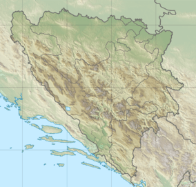 Location of Grančarevo Dam in Bosnia and Herzegovina | |
| Country | Bosnia and Herzegovina |
| Location | Gornje Grančarevo, Trebinje |
| Coordinates | 42°44′2.15″N 18°29′48.57″E / 42.7339306°N 18.4968250°ECoordinates: 42°44′2.15″N 18°29′48.57″E / 42.7339306°N 18.4968250°E |
| Purpose | Flood control, power |
| Status | Operational |
| Opening date | 1967 |
| Dam and spillways | |
| Type of dam | Arch |
| Impounds | Trebišnjica River |
| Height | 123 m (404 ft) |
| Length | 439 m (1,440 ft) |
| Width (crest) | 4.6 m (15 ft) |
| Width (base) | 27 m (89 ft) |
| Reservoir | |
| Creates | Bileća Lake |
| Total capacity | 1,280,000,000 m3 (1,040,000 acre·ft) |
| Active capacity | 1,082,000,000 m3 (877,000 acre·ft) |
| Power station | |
| Name | Trebinje-1(Čapljina) Hydroelectric Power Station |
| Commission date | 1968 |
| Type | Conventional |
| Hydraulic head | 104.5 m (343 ft) |
| Turbines | 3 x 60 MW Francis-type |
| Installed capacity | 180 MW |
The Grančarevo Dam is an arch dam on the Trebišnjica River near Gornje Grančarevo in the municipality of Trebinje in Bosnia and Herzegovina. At 123 m (404 ft) in height, it is the tallest dam in the country. Its reservoir, Bileća Lake, is the largest by volume in Bosnia and Herzegovina as well. The dam provides for flood control and hydroelectric power generation. The dam was completed in 1967 and its 180 MW power station, Trebinje-1 (Čapljina) Hydroelectric Power Station, was commissioned in 1968. A smaller 8 MW power station, Treblinje-2, was completed downstream in 1979.[1][2]
References
- ↑ "Countries, regions, transboundary river basins (select "Bosnia and Herzegovina" and "Dams")". United Nations FAO. Retrieved 27 May 2014.
- ↑ "Hydroelectric power on Trebišnjici" (in Croatian). Electric Power Industry of the Republic of Serbian. Retrieved 27 May 2014.
This article is issued from Wikipedia - version of the 4/30/2016. The text is available under the Creative Commons Attribution/Share Alike but additional terms may apply for the media files.