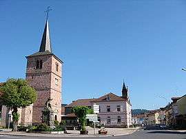
Granges-sur-Vologne
| Granges-sur-Vologne | ||
|---|---|---|
 | ||
| ||
 Granges-sur-Vologne | ||
|
Location within Grand Est region  Granges-sur-Vologne | ||
| Coordinates: 48°08′47″N 6°47′22″E / 48.1464°N 6.7894°ECoordinates: 48°08′47″N 6°47′22″E / 48.1464°N 6.7894°E | ||
| Country | France | |
| Region | Grand Est | |
| Department | Vosges | |
| Arrondissement | Saint-Dié-des-Vosges | |
| Canton | Corcieux | |
| Intercommunality | Monts de Vologne | |
| Government | ||
| • Mayor (2008–2014) | Sylvie Broglio | |
| Area1 | 29.64 km2 (11.44 sq mi) | |
| Population (2006)2 | 2,356 | |
| • Density | 79/km2 (210/sq mi) | |
| Time zone | CET (UTC+1) | |
| • Summer (DST) | CEST (UTC+2) | |
| INSEE/Postal code | 88218 / 88640 | |
| Elevation |
473–922 m (1,552–3,025 ft) (avg. 499 m or 1,637 ft) | |
| Website | www.granges-sur-vologne.com | |
|
1 French Land Register data, which excludes lakes, ponds, glaciers > 1 km² (0.386 sq mi or 247 acres) and river estuaries. 2 Population without double counting: residents of multiple communes (e.g., students and military personnel) only counted once. | ||

Granges-sur-Vologne is a former commune in the Vosges department in northeastern France. On 1 January 2016, it was merged into the new commune Granges-Aumontzey.[1]
See also
References
- ↑ Arrêté préfectoral 28 September 2015 (French)
External links
| Wikimedia Commons has media related to Granges-sur-Vologne. |
This article is issued from Wikipedia - version of the 11/21/2016. The text is available under the Creative Commons Attribution/Share Alike but additional terms may apply for the media files.