Green Bay, New Zealand
| Green Bay | |
|---|---|
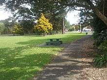
 A park in Green Bay | |
| Basic information | |
| Local authority | Auckland Council |
| Population | 3,936 (2006) |
| Surrounds | |
| North | New Lynn |
| Northeast | Avondale |
| East | Blockhouse Bay |
| Southeast | (Manukau Harbour) |
| South | (Manukau Harbour) |
| Southwest | Wood Bay |
| West | Titirangi |
| Northwest | Titirangi North |
Green Bay is an Auckland suburb. It is under the local governance of the Auckland Council. The population was 3,936 in the 2006 Census, an increase of 321 from 2001.[1] The main road running through Green Bay is Godley Road and this is the Urban Route 15 that follows through Green Bay to Titirangi and Laingholm.[2]
Green Bay beach is part of the Karaka Park coastal walk.[3] In pre-European times, the beach was the southern end of a portage between the Waitemata and Manukau harbours via the Whau River. At the west end of the beach there was a large Māori pā at Motukaraka (which is today Karaka Park).[4] The area was originally called Karaka Bay, but was renamed to the current name to avoid confusion with other bays named Karaka.[5]
Education
Green Bay High School is a secondary (years 9-13) school with a decile rating of 8 and a roll of 1467.[6] It opened in 1972.[7]
Green Bay Primary School is a full primary (years 1-8) school with a decile rating of 7 and a roll of 594.[8] It opened in 1960, and covered years 1-6 until an intermediate department was added in 1987.[9]
Both schools are coeducational, and situated next to each other on Godley Road.
Notes
- ↑ Quickstats about Green Bay
- ↑ Gregory's Auckland & Surrounds Street Directory (3rd ed.). 2008. p. map 105. ISBN 978-0-7319-2048-8.
- ↑ "Manukau Harbour Beaches". Waitakere City Council. Archived from Bay the original Check
|url=value (help) on 19 May 2009. Retrieved 2009-05-14. - ↑ Glen, A.W. (November 2006). "Manukau coastline, from Green Bay to Onehunga". Blockhouse Bay Historical Society. Archived from the original on 5 January 2009. Retrieved 2009-05-14.
- ↑ Discover New Zealand:A Wises Guide (9th ed.). 1994. p. 18.
- ↑ Te Kete Ipurangi schools database: Green Bay High School
- ↑ "About Us". Green Bay High School. Retrieved 2009-05-14.
- ↑ Te Kete Ipurangi schools database: Green Bay Primary School
- ↑ "A Brief History". Green Bay Primary School. Retrieved 2009-05-14.
Coordinates: 36°55′46″S 174°41′06″E / 36.92944°S 174.68500°E