Grgelj
| Grgelj | |
|---|---|
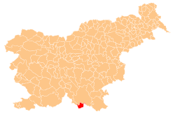
 Grgelj Location in Slovenia | |
| Coordinates: 45°31′16.95″N 14°56′56.05″E / 45.5213750°N 14.9489028°ECoordinates: 45°31′16.95″N 14°56′56.05″E / 45.5213750°N 14.9489028°E | |
| Country |
|
| Traditional region | Lower Carniola |
| Statistical region | Southeast Slovenia |
| Municipality | Kostel |
| Area | |
| • Total | 2.06 km2 (0.80 sq mi) |
| Elevation | 243.3 m (798.2 ft) |
| Population (2014) | |
| • Total | 1 |
| • Density | 1/km2 (3/sq mi) |
| [1] | |
Grgelj (pronounced [ˈɡəɾɡəl]; German: Beim Gergel,[2] Beim Görgel[3]) is a dispersed settlement that stretches along the left bank of the Kolpa River in the Municipality of Kostel in southern Slovenia. The area is part of the traditional region of Lower Carniola and is now included in the Southeast Slovenia Statistical Region.[4]
References
- ↑ Statistical Office of the Republic of Slovenia
- ↑ Leksikon občin kraljestev in dežel zastopanih v državnem zboru, vol. 6: Kranjsko. 1906. Vienna: C. Kr. Dvorna in Državna Tiskarna, p. 39.
- ↑ Gottschee und Tschernembl (map, 1:75,000). 1896. Vienna: K.u.k. Militärgeographisches Institut.
- ↑ Kostel municipal site
External links
| Settlements | Administrative centre: Fara
|  | ||||||
|---|---|---|---|---|---|---|---|---|
| Landmarks | ||||||||
This article is issued from Wikipedia - version of the 7/23/2015. The text is available under the Creative Commons Attribution/Share Alike but additional terms may apply for the media files.