Grizzly Peak (Mariposa County, California)
| Grizzly Peak | |
|---|---|
| Highest point | |
| Elevation | 6,222 ft (1,896 m) NGVD 29[1] |
| Prominence | 182 ft (55 m) [1] |
| Coordinates | 37°43′47″N 119°33′03″W / 37.7296483°N 119.5507175°WCoordinates: 37°43′47″N 119°33′03″W / 37.7296483°N 119.5507175°W [2] |
| Geography | |
| Location |
Yosemite National Park Mariposa County, California, U.S. |
| Parent range | Sierra Nevada |
| Topo map | USGS Half Dome |
| Climbing | |
| First ascent | 1885 by Charles A. Bailey[3] |
| Easiest route | Exposed scramble, class 3[4] |
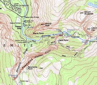
Map showing Grizzly Peak
Grizzly Peak in Yosemite Valley is a promontory on the southwest wall below the popular Half Dome. It can be seen on the hike to Vernal Fall and Nevada Fall, from northeastern Glacier Point, and various other locations in the Yosemite Valley. The top is not accessible by any trail, although rock climbers frequent the peak.[4]
References
- 1 2 "Grizzly Peak, California". Peakbagger.com. Retrieved 2012-12-17.
- ↑ "Grizzly Peak". Geographic Names Information System. United States Geological Survey. Retrieved 2012-12-17.
- ↑ Farquhar, Francis P. (1926). Place Names of the High Sierra. San Francisco: Sierra Club. Retrieved 2009-08-04.
- 1 2 "Grizzly Peak". SummitPost.org. Retrieved 2016-03-27.
This article is issued from Wikipedia - version of the 3/27/2016. The text is available under the Creative Commons Attribution/Share Alike but additional terms may apply for the media files.