Hålandsdal
| Hålandsdal kommune | |
|---|---|
| Former Municipality | |
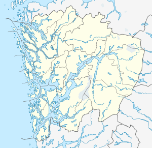
 Hålandsdal kommune Location in Hordaland county | |
| Coordinates: 60°14′N 05°49′E / 60.233°N 5.817°ECoordinates: 60°14′N 05°49′E / 60.233°N 5.817°E | |
| Country | Norway |
| Region | Western Norway |
| County | Hordaland |
| District | Midhordland |
| Municipality ID | NO-1239 |
| Adm. Center | Holdhus |
| Area[1] | |
| • Total | 131 km2 (51 sq mi) |
| Population (1963) | |
| • Total | 534 |
| Time zone | CET (UTC+01:00) |
| • Summer (DST) | CEST (UTC+02:00) |
| Created as | Fusa in 1903 |
| Merged into | Fusa in 1964 |
Hålandsdal is a former municipality in Hordaland county, Norway. The 131-square-kilometre (51 sq mi) municipality encompassed the northeastern part of present-day municipality of Fusa. It included the large lakes Skogseidvatnet and Gjønavatnet and all of their surrounding valleys. The administrative centre of the municipality was the village of Holdhus where the Holdhus Church is located.[1]
History
On 1 January 1903, the parish of Hålandsdal was separated from the municipality of Fusa to form a separate municipality of its own. Initially, Hålandsdal had a population of 647. It was a small municipality and so in the early 1960s, the Schei Committee recommended that it be merged with two of its neighbors: Fusa and Strandvik. So, on 1 January 1964, Hålandsdal was merged with Strandvik and most of Fusa, creating a new, larger municipality of Fusa. Prior to the merger, Hålandsdal had a population of 528.[2]
References
- 1 2 Store norske leksikon. "Hålandsdal" (in Norwegian). Retrieved 2014-07-14.
- ↑ Jukvam, Dag (1999). "Historisk oversikt over endringer i kommune- og fylkesinndelingen" (PDF) (in Norwegian). Statistisk sentralbyrå.