HaiYang
HaiYang (Chinese: 海洋; literally: "ocean"), abbreviated HY, is a marine remote sensing satellite series planned by China. The first marine remote sensing satellite, named HY-1A, launched on May 15, 2002.[1] The latest ocean satellite named HY-2A lanched on August 16, 2011.[2] The HaiYang series is operaterd by NSOAS(National Satellite Ocean Application Service), the subordinate agency of State Oceanic Administration.

HY-2A Launching Time
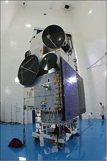
Alternate view of the HY-2A spacecraft

Artist's view of the deployed HY-2A spacecraft
Current and previous satellites
| Launch date | Satellites | Vehicle | Orbit | In use | Sensors |
|---|---|---|---|---|---|
| 2002-05-15 | HY-1A | CZ-4B | SSO | No | COCTS (Chines Ocean Color and Temperature Scanner), CZI (Coastal Zone Imager) |
| 2007-04-11 | HY-1B | CZ-2C | SSO | Yes | COCTS (Chines Ocean Color and Temperature Scanner), CZI (Coastal Zone Imager) |
| 2011-08-16 | HY-2A | CZ-4B | SSO | Yes | MWRI (Microwave Radiometer Imager), RA (Radar Altimeter), Ku-RFSCAT (Ku-Band Rotational Fan-beam Scatterometer) |
Data Applications
See also
References
- ↑ Launch Records;China's Satellite Launch Centers
- ↑ China Launches New Ocean-Watching Satellite; Stephen Clark, Space.com, August 16, 2011 03:46pm ET
- ↑ HaiYang Satellite Products
- ↑ AVISO+ current missions HY-2
External links
- Haiyang satellite programme (in Chinese)
This article is issued from Wikipedia - version of the 7/19/2016. The text is available under the Creative Commons Attribution/Share Alike but additional terms may apply for the media files.