Halberton
| Halberton | |
 Halberton |
|
| Population | 865 (Parish 2011) |
|---|---|
| OS grid reference | SS955125 |
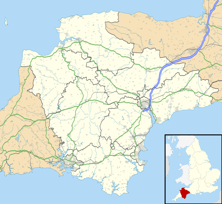
| District | Mid Devon |
| Shire county | Devon |
| Region | South West |
| Country | England |
| Sovereign state | United Kingdom |
| Post town | TIVERTON |
| Postcode district | EX16 |
| Dialling code | 01844 |
| Police | Devon and Cornwall |
| Fire | Devon and Somerset |
| Ambulance | South Western |
| EU Parliament | South West England |
| UK Parliament | Tiverton & Honiton |
Coordinates: 50°54′09″N 3°29′15″W / 50.9025°N 3.4875°W
Halberton is a village and civil parish in Devon, England. The Grand Western Canal runs through the village. The village is situated between the historic market towns of Tiverton and Cullompton.
The large parish has an area of about 7,520 acres (30.4 km2)[1] and it is surrounded, clockwise from the north, by the parishes of Uplowman, Sampford Peverell, Burlescombe, Uffculme, Willand, Cullompton, Butterleigh, Silverton, Bickleigh and Tiverton.[2]
Its name is derived from ‘Haligbeort’ (Albert), the name of the Saxon Chief, and ‘tun’, a farm settlement. There is an electoral ward with the same name. The ward population at the 2011 Census was 2,096.[3] Halberton was once important enough to be a Hundred, an administrative division of a shire. The hundred of Halberton included the parishes of Halberton, Sampford Peverell and Willand, as well as parts of Uplowman and Burlescombe. Many of the farms date back to Domesday or shortly after and Halberton is still largely a farming community.
Halberton village is divided into two parts, Higher Town and Lower Town, separated by the mill stream and pond. The pond is fed by warm springs and never freezes.
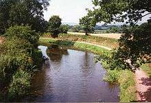
The Great Western Railway once had a branch line running through Halberton to Tiverton, but this has now gone. However, the Grand Western Canal still runs through the village and this is now a country park. It is 11 miles (18 km) long running from Tiverton to Loudwells. Rock Bridge was constructed to carry the road (formerly the A373) over the canal.[4] The same engineers that built the canal also built a substantial country house,[5] turnpike house[6] and cottages[7] at the site. Several other bridges were also constructed at Halberton to carry minor roads over the canal.[8][9][10][11][12][13]
There are several old houses in the village, the most notable being ‘The Priory’, believed to date from the 14th century, when it was part of a college called St. Jude’s. This was occupied by monks of the order of St. Augustine. The building known to be the oldest is the Mill House, which was registered in the doomsday book (1086) as town mills. Townsend House (now demolished) dated from the early 18th century, and several other houses in the village date from the 17th and 18th centuries.
The parish church dates from the 14th century and stands at the centre of the village. It is thought to have been constructed on the site of an earlier Saxon church. There is also a Methodist Chapel at which John Wesley preached, first in 1760, and again between 1779 and 1789. Halberton also has a Christian Fellowship Group, which meets in Ash Thomas Church.
The Primary School, erected in 1844 has seen many changes and extensions over the years, and although still small is well equipped with modern equipment.
There is an active Parish Council, and many other organisations which cater for all tastes, including a Women’s Institute and a branch of the British Legion.
References
- ↑ "An Introduction". Halberton Parish. Retrieved 15 July 2016.
- ↑ "Map of Devon Parishes" (PDF). Devon County Council. Retrieved 7 July 2016.
- ↑ "Ward population 2011.Retrieved 22 Feb 2015".
- ↑ "Rock Bridge at Halberton". Images of England. Retrieved 2007-12-06.
- ↑ "Rock House and adjacent range of outbuildings". Images of England. Retrieved 2007-12-06.
- ↑ "Turnpike Cottage". Images of England. Retrieved 2007-12-06.
- ↑ "Cottage 100 metres east of Rock - House". Images of England. Retrieved 2007-12-06.
- ↑ "Batten's Bridge". Images of England. Retrieved 2007-12-06.
- ↑ "Accommodation bridge over the Grand Western Canal". Images of England. Retrieved 2007-12-06.
- ↑ "Bridge at Halberton". Images of England. Retrieved 2007-12-06.
- ↑ "Crownhills Bridge". Images of England. Retrieved 2007-12-06.
- ↑ "Greenway Bridge". Images of England. Retrieved 2007-12-06.
- ↑ "Sellick Bridge". Images of England. Retrieved 2007-12-06.
External links
| Wikimedia Commons has media related to Halberton. |