Hanglip
| Hanglip | |
|---|---|
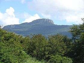 Hanglip from the southeast | |
| Highest point | |
| Elevation | 1,719 m (5,640 ft) [1] |
| Listing | List of mountains in South Africa |
| Coordinates | 22°59′45″S 29°53′0″E / 22.99583°S 29.88333°ECoordinates: 22°59′45″S 29°53′0″E / 22.99583°S 29.88333°E |
| Geography | |
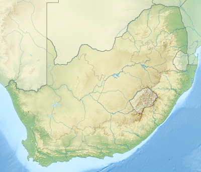 Hanglip Location in South Africa | |
| Location | Limpopo |
| Parent range | Soutpansberg |
Hanglip (Afrikaans for hanging lip, Venda: Songozwi[2]) is a prominent mountain peak near Louis Trichardt, South Africa. It is situated in the Vhembe District of Limpopo in the central Soutpansberg range. The peak with radar station, at 1,719 meters a.s.l., forms a conspicuous landmark visible from the town and the N1 national road.
Hanglip mountain is situated in the 354 hectare Hanglip Forest Reserve within the Hanglip State Forest. The state forest contains commercial pine plantations, protected natural forest and bushveld. The pine plantations are harvested in 30 to 40 year cycles for construction wood.
Geologically the mountain consists of tilted layers of the Karoo succession including glacial till deposits. Red quartzite deposits and grey andesite lava intrusions are also present.
From 1867 the area was controlled by the Venda after they acquired rifles from elephant hunters. In 1898 the Venda under Mphefu were evicted from Schoemansdal by the Boere under the leadership of general Piet Joubert. As safeguard against further attacks, Fort Botha was established under Hanglip some kilometers southwest of Mphefu's kraal. The ruins of the fort are currently off limits, being situated near graves of Venda captains held sacred by the tribe. The town of Trichardtsdorp was established after the conflict.
The Hanglip Forest Reserve is a protected area in the zone of the mountain.[3] Hikers can arrange to overnight in the Hanglip trail hut east of the peak, and motorists can visit a picnic site against its southern slope.[4]
References
- ↑ Explore the Hanglip Hiking Trail
- ↑ Braun, Lindsay F. (2014). Colonial Survey and Native Landscapes in Rural South Africa, 1850 - 1913: The Politics of Divided Space in the Cape and Transvaal (revised ed.). BRILL. p. 254. ISBN 9789004282292.
- ↑ Hanglip Forest Reserve, Louis Trichardt, Soutpansberg
- ↑ Soutpansberg/Hanglip hiking trail, Department of Forestry