Harbour of Eleutherios
The Harbour of Eleutherios (Greek: λιμήν Ἐλευθερίου), later known as the Harbour of Theodosius (Greek: λιμήν Θεοδοσίου, Latin: Portus Theodosiacus) was one of the ports of ancient Constantinople, the capital of the Byzantine Empire, located beneath the modern Yenikapi neighbourhood of Istanbul, Turkey).
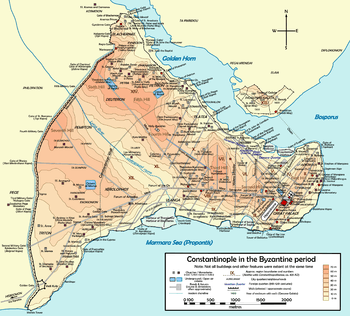
The harbour was located on the south side of the peninsula where the city is built, facing towards the Sea of Marmara. The other harbours of the city were the Harbour of Julian and the small harbour of the Boukoleon Palace, likewise on the southern shore, and the harbours of Neorion and Prosphorion on the northern side. The harbour was built in the late 4th century during the reign of Theodosius I, and was the city's major point of trade in Late Antiquity.[1] The area was later transformed for agricultural use due to the effects of erosion and silting.[2] In Ottoman times, the area was built over.
In November 2005, workers on the Bosphorus Tunnel Project discovered the silted-up remains of the harbour. Excavations produced evidence of the 4th-century Port of Theodosius. There, archaeologists uncovered traces of the city wall of Constantine the Great, and the remains of over 35 Byzantine ships from the 7th to 10th centuries, including several Byzantine galleys, remains of which had never before been found.[3] In addition, the excavation has uncovered the oldest evidence of settlement in Constantinople, with artifacts, including amphorae, pottery fragments, shells, pieces of bone, horse skulls, and nine human skulls found in a bag, dating back to 6000 BC.[4]
Gallery
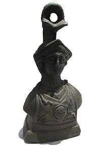
 Various findings from the Byzantine era
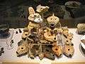 Oil lamps found at Yenikapı
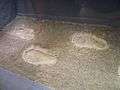 Footprints found at Yenikapı
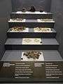 Seeds found at Yenikapı
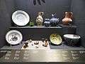 Plates and vessels found at Yenikapı
 Animal bones found at Yenikapı
References
- ↑ "Archaeology slows down building of Europe-Asia tunnel". Manchu Project. Retrieved 15 October 2010.
- ↑ "Lost Treasures of Constantinople Test Turkey's 21st-century Ambition". Guardian News & Media. Retrieved 15 October 2010.
- ↑ Rose, Mark; Aydingün, Sengül. "Under Istanbul". Archaeology.org. Archaeological Institute of America. Retrieved 2008-10-27.
- ↑ Nautical archaeology takes a leap forward
External links
![]() Media related to Eleutherion at Wikimedia Commons
Media related to Eleutherion at Wikimedia Commons
Coordinates: 41°0′16.8″N 28°57′8″E / 41.004667°N 28.95222°E