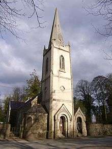
Harristown, County Kildare

Harristown (Irish: Baile Anraí)[1] is a townland in County Kildare on the River Liffey 2.5 miles (4.0 km) downstream from Kilcullen,[2] just north of Brannockstown[3] in the civil parish of Carnalway in the barony of Naas North.[1] It was formerly a borough and manor, and Harristown Borough was a borough constituency sending two MPs to the Irish House of Commons before the Acts of Union 1800.[2] The townland was a part of the demesne of Castlemartin House and Estate which was sold by the Eustace baronets to the first Duke of Leinster, and resold by his son to the La Touche family, who built Harristown House there.[3] In 1684 (regnal year 33),[4] Sir Maurice Eustace obtained a royal charter from Charles II incorporating Harristown as a borough, comprising 100 acres (40 ha).[2] The borough was a rotten borough with "not one house and but one tree inhabiting".[4] The 1684 charter also established a manor of Harristown, with a court leet, court baron and court of record for 4,000 acres (1,600 ha) of land in the townlands of Harristown, Dunstown, Carnalway, Milltown and others.[2] In 1837, Samuel Lewis described Harristown as "an inconsiderable village", though there was an Irish Constabulary barracks there.[5]
References
- 1 2 "Harristown". Placenames Database of Ireland. Retrieved 1 August 2013.
- 1 2 3 4 "Harristown". The Parliamentary Gazetteer of Ireland: Adapted to the New Poor-law, Franchise, Municipal and Ecclesiastical Arrangements, and Compiled with a Special Reference to the Lines of Railroad and Canal Communication, as Existing in 1844–45. Vol.II: D-M. A. Fullarton and Company. 1846. p. 295.
- 1 2 "Harristown House, Brannockstown, County Kildare, Ireland". History & Heritage. Kildare Community Network. Retrieved 1 August 2013.
- 1 2 "Constituencies: Harristown". History of the Irish Parliament. Ulster Historical Foundation. Retrieved 1 August 2013.
- ↑ "Harristown (Kildare)". A Topographical Dictionary of Ireland. libraryireland. 1837. Retrieved 1 August 2013.
Coordinates: 53°08′12″N 6°41′19″E / 53.1367°N 6.6885°E