Hatlerdorf
Hatlerdorf is the second precinct of the City of Dornbirn (Vorarlberg, Austria).
History
Hatlerdorf is most likely the oldest settled area in Dornbirn. Relatively late - in 1902, a year after Dornbirn's elevation to municipal status - "Niederdorf" (now called Markt), Hatlerdorf, Oberdorf and Haselstauden were officially declared to be the four precincts of the new municipality. In 1994 the new areas in the northwestern part of the precinct were made precincts themselves - the 5th precinct Rohrbach and the 6th precinct Schoren.
Economy
For a long time Hatlerdorf was predominantly agricultural, and it continues to play a leading role within Dornbirn's important agricultural sector. During times of industrialization large textile enterprises settled on the southern edge of the precinct (Wallenmahd). Today, Hatlerdorf is rapidly becoming an industrial center, with such larger firms as Zumtobel Lighting, the Vorarlberg Spar Central Offices and Distribution, J.M. Fußenegger, the EHG Steel Center, and Blum Fittings.
Infrastructure
Hatlerdorf has its own post office, several bank branches, the Catholic parish St. Leopold, the Dornbirn Municipal Hospital and a residential care home for the elderly.
Transportation
The L 190 highway cuts through the precinct. Shortly before reaching the 1. Bezirk it crosses the L 204 Lustenauer Strasse. The Rheintal/Walgau Autobahn passes through the precinct area, but the closest direct connection is Dornbirn South. Since the opening of the Vorarlberg Railway Vorarlbergbahn in 1872 Hatlerdorf has had its own railroad station.
Geography
Hatlerdorf extends from the Dornbirn Ach Dornbirner Ach in the northeast and the foot of the Karren mountain in the southeast out into the Rhine valley plain, bordering in the west on Lustenau and in the south on Hohenems.
Sights
Parish church St. Leopold (built 1860 – 1866)
This Neo-Romantic church in Hatlerdorf was built after the plans of the Bavarian Court Building Inspector "Eduard von Riedel". The external structure was renovated in 1977.
-

Pfarrkirche St. Leopold
-
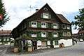
alter Dorfkern
-

IM.Fussenegger
Coordinates: 47°24′07″N 9°44′18″E / 47.4019°N 9.7383°E