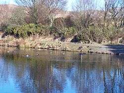
Helensburgh No. 1 Reservoir
National grid reference NS30468387
| Helensburgh, No 1 Reservoir | |
|---|---|
 | |
| Location | Helensburgh, Scotland |
| Coordinates | 56°01′07″N 4°43′08″W / 56.0186°N 4.7188°WCoordinates: 56°01′07″N 4°43′08″W / 56.0186°N 4.7188°W |
| Type | Reservoir |
| Basin countries | Scotland, United Kingdom |
| Surface area | 39,500 sq. metres |
| Water volume | 117,000 cubic metres |
| Surface elevation | 107 metres |
The reservoir is of the non-impounding variety. It is no longer part of the local water supply system and is used by Helensburgh Angling Club. The earthen dam is 6 metres high and records show it was constructed before 1868.[1]
See also
References
- ↑ "Overview of Helensburgh No.1 Reservoir". Scottish-places.info. Retrieved 2014-05-27.
Sources
This article is issued from Wikipedia - version of the 8/2/2015. The text is available under the Creative Commons Attribution/Share Alike but additional terms may apply for the media files.