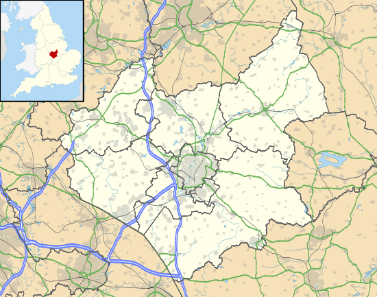
Higham on the Hill
| Higham on the Hill | |
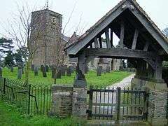 Parish church of Saint Peter |
|
 Higham on the Hill |
|
| Population | 840 (2011 Census) |
|---|---|
| OS grid reference | SP383954 |
| District | Hinckley and Bosworth |
| Shire county | Leicestershire |
| Region | East Midlands |
| Country | England |
| Sovereign state | United Kingdom |
| Post town | NUNEATON |
| Postcode district | CV13 |
| Dialling code | 01455 |
| Police | Leicestershire |
| Fire | Leicestershire |
| Ambulance | East Midlands |
| EU Parliament | East Midlands |
| UK Parliament | Bosworth |
|
|
Coordinates: 52°33′20″N 1°26′08″W / 52.55569°N 1.43569°W
Higham on the Hill is a village and civil parish in the Hinckley and Bosworth district of Leicestershire, England.[1] The population at the 2011 census was 840.[2]
Geography
The village is about three miles away from both Hinckley and Nuneaton. The parish (and the boundary between the East and West Midlands) is bounded by Warwickshire and the A5 to the south-west.
The parish includes the deserted village of Lindley that was mentioned in the Domesday Book and gave its name to RAF Lindley the site of which was acquired by the automotive research institute MIRA Ltd for its proving ground opened on 22 May 1954.
The Ashby Canal passes through the east of the parish, and the parish boundary runs along it near Stoke Golding.
The Ashby and Nuneaton Joint Railway used to pass through the parish, with a railway station for the village, the route is now the Weddington Country Walk.
Geographical centre of England
The geographical centre of England as defined by the Ordnance Survey lies within the parish at latitude 52°33'N, longitude 01°27'W, just north of Watling Street.
Amenities
The parish church is dedicated to St Peter.
The village has a pub The Oddfellows.
Higham Green College lies to the south-east.
Notable residents
- Robert Burton, author of The Anatomy of Melancholy, was born in Lindley
- Geoffrey Fisher, Lord Archbishop of Canterbury from 1944 to 1961, was born in the village in 1887 and lived in the rectory
External links
| Wikimedia Commons has media related to Higham on the Hill. |
References
- ↑ OS Explorer Map 232 : Nuneaton & Tamworth: (1:25 000) :ISBN 0 319 46404 0
- ↑ "Civil Parish population 2011". Neighbourhood Statistice. Office for National Statistics. Retrieved 14 June 2016.