Wisconsin Highway 72
| ||||
|---|---|---|---|---|
| Route information | ||||
| Maintained by WisDOT | ||||
| Length: | 29.44 mi[1] (47.38 km) | |||
| Major junctions | ||||
| West end: |
| |||
|
| ||||
| East end: |
| |||
| Location | ||||
| Counties: | Pierce, Dunn | |||
| Highway system | ||||
| ||||

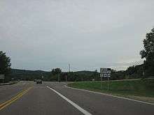
State Trunk Highway 72 (often called Highway 72, STH 72 or WIS 72) is a 29.44-mile (47.38 km) state highway in the U.S. state of Wisconsin. It runs in west central Wisconsin from U.S. Route 10 and U.S. Route 63 east of Ellsworth east to Wisconsin Highway 25 in Downsville. Highway 72 passes through Pierce and Dunn Counties. The road is maintained by the Wisconsin Department of Transportation.
Route description
Highway 72 begins at an intersection with US 10 and US 63 in the Town of Ellsworth in Pierce County, east of the village of the same name. From here, the highway heads east concurrently with US 63. The roads pass through a rural area together until US 63 splits off to the north. Highway 72 continues eastward, intersecting County Highway DD before entering the Town of El Paso. After crossing the Rush River, the highway briefly follows the river's edge before continuing eastward. The road passes through the communities of Waverly and Rock Elm, then turns northeast toward Elmwood. In Elmwood, the highway intersects Highway 128 at that route's southern terminus, then turns east and leaves the village.[2] Past Elmwood, Highway 72 then enters the Town of Weston in Dunn County. The road heads east through farmland, crossing the Eau Galle River after meeting County Highway C for the first time. It then intersects County Highways D and K before entering the Town of Dunn. The highway curves to the southeast before terminating at an intersection with Highway 25 and County Highway C in Downsville. The Red Cedar River lies immediately to the east of the terminus.[3][4]
Major intersections
| County | Location | mi[4] | km | Destinations | Notes |
|---|---|---|---|---|---|
| Pierce | Town of Ellsworth | 0.0 | 0.0 | Western terminus | |
| 1.7 | 2.7 | ||||
| Elmwood | 17.7 | 28.5 | |||
| Dunn | Downsville | 29.3 | 47.2 | Eastern terminus | |
1.000 mi = 1.609 km; 1.000 km = 0.621 mi
| |||||
References
- ↑ Bessert, Chris. "Wisconsin Highways: Highways 70-79 (Highway 72)". Wisconsin Highways. Retrieved 2007-03-20.
- ↑ Pierce County (PDF) (Map). Wisconsin Department of Transportation. 2011. Retrieved December 19, 2011.
- ↑ Dunn County (PDF) (Map). Wisconsin Department of Transportation. 2011. Retrieved December 19, 2011.
- 1 2 Google (December 19, 2011). "Overview map of Highway 72" (Map). Google Maps. Google. Retrieved December 19, 2011.