Hisarya Cove

Location of Smith Island in the South Shetland Islands.
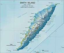
Topographic map of Smith Island.
Hisarya Cove (Bulgarian: залив Хисаря, ‘Zaliv Hisarya’ \'za-liv hi-'sa-rya\) is the 950 m wide cove on the northwest side of Osmar Strait indenting for 500 m the southeast coast of Smith Island in the South Shetland Islands, Antarctica south of Dupnitsa Point and 7.6 km northeast of Cape James. Its head is fed by Letnitsa Glacier. Bulgarian early mapping in 2009.
The cove is named after the town of Hisarya in southern Bulgaria.
Coordinates: 63°03′29″S 62°35′36″W / 63.05806°S 62.59333°W
Maps
- L.L. Ivanov. Antarctica: Livingston Island and Greenwich, Robert, Snow and Smith Islands. Scale 1:120000 topographic map. Troyan: Manfred Wörner Foundation, 2009. ISBN 978-954-92032-6-4
References
This article includes information from the Antarctic Place-names Commission of Bulgaria which is used with permission.
This article is issued from Wikipedia - version of the 11/13/2016. The text is available under the Creative Commons Attribution/Share Alike but additional terms may apply for the media files.