Hodbarrow RSPB reserve
| RSPB Hodsbarrow | |
| Nature reserve | |
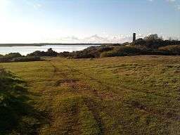
 View over reserve | |
| Country | England |
|---|---|
| County | Cumbria |
| For public | Open year round |
| Protection status | SSSI,[1] Special Protection Area |
| Website: Hodbarrow | |
Hodbarrow RSPB Reserve is a nature reserve run by the Royal Society for the Protection of Birds on the edge of the Lake District National Park in Cumbria, England. It is on the Duddon Estuary near the town of Millom.
History
The nature reserve occupies a site where iron ore was mined until the 1960s. The mining caused subsidence, leading to flooding since the closure of the mine, as the site is no longer dewatered. The reserve continues to be protected from the sea by a seawall completed in 1905.[2] Most of the area of the reserve is taken up by Hodbarrow Lagoon, a flooded part of the former mine, which is described as a "coastal lagoon".[3]
Facilities
There is a car park on the Millom side of the reserve from which you can walk to the seawall. (Alternatively, there is more direct pedestrian access to the seawall from Haverigg).

There is a bird hide on the seawall which gives views of the lagoon.
Protection status
The lagoon was originally a separate Site of Special Scientific Interest, notified in 1983. Following an amalgamation of SSSIs, it is part of the Duddon Estuary Site of Special Scientific Interest.[1] The Duddon estuary is also an Important Bird Area,[4] and a Special Protection Area.[5]
Wildlife
Hodbarrow has breeding populations of terns. It is renowned for large numbers of wildfowl during the winter, especially teal, widgeon, coot, mallard, tufted duck, common pochard, goldeneye, red-breasted merganser, and occasionally long-tailed duck, eider, goosander, pintail and shoveller.
References
- 1 2 "Duddon Estuary, Cumbria" (PDF). Natural England. Retrieved 17 August 2015.
- ↑ Hodbarrow Sea Defences
- ↑ Hodbarrow. RSPB
- ↑ BirdLife International (2016) Important Bird and Biodiversity Area factsheet: Duddon Estuary. Downloaded from http://www.birdlife.org on 21/08/2016
- ↑ "Duddon Estuary". Retrieved 21 August 2016.
External links
- RSPB Hodbarrow
- Millom's premier information website
- Millom information website
- The Cumbria Directory - Hodbarrow Nature Reserve
- Hodbarrow Woodland Trust (VisitWoods website)
Coordinates: 54°11′59″N 3°15′54″W / 54.1998°N 3.2651°W