Hogsty Reef
| Hogsty Reef, Bahamas | |
|---|---|
|
At the head of the lagoon, Hogsty Reef (Eastern end) | |
 | |
| Coordinates | 21°41′N 73°49′W / 21.683°N 73.817°WCoordinates: 21°41′N 73°49′W / 21.683°N 73.817°W |
 Bahamas | |
| Location |
Hogsty Reef Mayaguana Bahamas |
|---|---|
| Coordinates | 21°41′37.2″N 73°50′50.2″W / 21.693667°N 73.847278°W |
| Construction |
stone tower (first) metal mast (current) |
| Tower shape |
conical frustum tower (first) mast light (current) |
| Markings / pattern | red tower (first) |
| Height |
4 metres (13 ft) (first) 7 metres (23 ft) (current) |
| Focal height | 9 metres (30 ft) (current) |
| Light source | solar power |
| Range | 8 nautical miles (15 km; 9.2 mi) |
| Characteristic | Fl W 4s. |
| Admiralty number | J4802 |
| NGA number | 12356 |
| ARLHS number | BAH-020[1] |
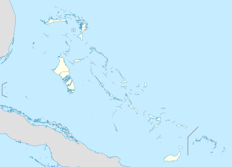
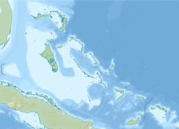
Hogsty Reef is a uninhabited coral atoll located in the southern Bahamas. It is located between Great Inagua (to the South) and Acklins Island (to the North).
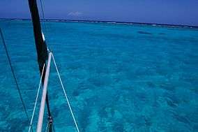
Hogsty is a bit of an oddity in the Atlantic basin. It is a 5×3 mile coral atoll rising up from 6,000 ft deep surrounding waters. Atolls are presumed to form from extinct volcanoes – in a process whereby the volcano creates the sea mount which rises from the ocean depths, then subsides leaving a coral atoll. There are just a handful of these geological formations in the Atlantic, whereas there are hundreds in the Pacific. Hogsty is uninhabited and hardly anyone ever visits. There are just two tiny islands – hardly larger than sandbars – not enough to offer any real lee anchorage. The islands are small enough to walk/circumnavigate in 5-10 minutes. They do offer good shelling. Most charts and guides call out an anchorage in the lee of NW Cay. It is also possible to anchor at the head of the lagoon. The lagoon is mostly 20-30 ft deep with scattered coral heads. Good light is needed to navigate it. Once at the head of the lagoon, there is a large field of 10 ft sand to anchor in. The charts indicate areas of the reef dry at low water, which suggests good protection from surge at low tide, but as of 2009, little of the reef actually dries.
There are two impressive shipwrecks on the reef.

One is a Liberty ship named Trebišnjica (ex SS Richmond P. Hobson), wrecked on the northern part of the reef 17 July 1963. These were made during World War II using a revolutionary construction technique whereby large sections of the ships were manufactured separately then welded together . At times, shipyards spat out a new Liberty ship every four days. 2,701 were made to support the transatlantic supply chain and keep ahead of the attrition rate inflicted by U-boats. As of 2009, this Liberty ship is well on its way to being reduced to dust. The superstructure is caving in and the hull is broken.
The second shipwreck is on the southern part of the reef. It’s much smaller than the Liberty ship – and looks like a small inter-island freight boat – maybe 120 feet long. The wreck appears to be much more recent and is in much better shape. The name is still plainly visible: Lady Eagle.
See also
References
- ↑ Hogsty Reef The Lighthouse Directory . University of North Carolina at Chapel Hill. Retrieved 24 August 2016
External links
- The Geomorphology and History of Hogsty Reef, a Bahamian Atoll, Milliman, John D., Bulletin of Marine Science, Volume 17, Number 3, September 1967, pp. 519-543
- Picture of Hogsty Reef Lighthouse