Hoher Kasten
| Hoher Kasten | |
|---|---|
 View from the west | |
| Highest point | |
| Elevation | 1,791 m (5,876 ft) |
| Prominence | 251 m (823 ft) [1] |
| Parent peak | Säntis |
| Coordinates | 47°17′0.8″N 9°29′7.4″E / 47.283556°N 9.485389°ECoordinates: 47°17′0.8″N 9°29′7.4″E / 47.283556°N 9.485389°E |
| Geography | |
 Hoher Kasten Location in Switzerland | |
| Location | Appenzell Innerrhoden/St. Gallen, Switzerland |
| Parent range | Appenzell Alps |
| Climbing | |
| Easiest route | Aerial tramway |
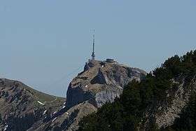
The Hoher Kasten is a mountain in the Appenzell Alps, overlooking the Rhine in Eastern Switzerland. It is located on the border between the cantons of Appenzell Innerrhoden and St. Gallen.
The summit is easily accessible with a cable car starting at Brülisau, south of Appenzell. A revolving restaurant, offering panoramic views, has been built on the top.
 View over the Alpstein from the summit
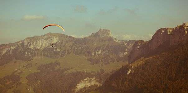 Paragliding at Hoher Kasten
Ascents to Hoher Kasten and the neighouring summit Kamor were already described in the early 19th century.[2]
See also
References
- ↑ Retrieved from the Swisstopo topographic maps and Google Earth. The key col is the Wenneli at 1,540 metres.
- ↑ Johann Rudolf Steinmüller: Beschreibung der schweizerischen Alpen- und Landwirthschaft, Steinersche Buchhandlung, 1802.
External links
 Media related to Hoher Kasten at Wikimedia Commons
- Cable car and panoramic restaurant (German)
- Hoher Kasten on Hikr
This article is issued from Wikipedia - version of the 5/9/2016. The text is available under the Creative Commons Attribution/Share Alike but additional terms may apply for the media files.