Holybourne Hill
| Holybourne Hill | |
|---|---|
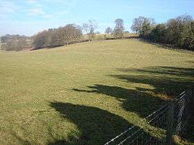 Holybourne Down with the line of an old Roman road passing through the centre of the image. | |
| Highest point | |
| Elevation | 225 m (738 ft) [1] |
| Prominence | 64 m (210 ft) [1] |
| Parent peak | Butser Hill [1] |
| Coordinates | 51°11′15″N 0°57′50″W / 51.1876°N 0.9640°WCoordinates: 51°11′15″N 0°57′50″W / 51.1876°N 0.9640°W |
| Geography | |
| Location | Hampshire, England |
| Parent range | Hampshire Downs |
| OS grid | SU725437 |
| Topo map | OS Landranger |
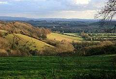
Looking down on Holybourne from Holybourne Down. The wood (left centre) is Angels' Heaven and the church (centre) is Holy Rood
Holybourne Hill or Holybourne Down is one of the highest points in the county of Hampshire, England, and in the Hampshire Downs, rising to 225 metres (738 ft) above sea level.
Holybourne Hill rises not far from the village of Holybourne in Hampshire.[2]
References
- 1 2 3 Summit Listings by Relative Height by Mark Jackson, compiled by Jonathan de Ferranti. Accessed on 15 May 2013.
- ↑ Ordnance Survey 1:50,000 Landranger series.
This article is issued from Wikipedia - version of the 7/11/2013. The text is available under the Creative Commons Attribution/Share Alike but additional terms may apply for the media files.