Homolje

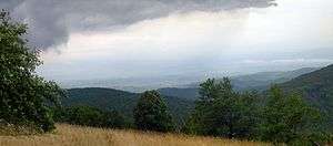
Homolje to the north
Homolje (Serbian Cyrillic: Хомоље, pronounced [xɔ̌mɔʎɛ]) is a small geographical region in east Serbia south of the Danube river. It is centered on the town of Žagubica, with smaller parts belonging to municipalities of Kučevo, Majdanpek and Petrovac. In the narrow sense, the term "Homolje" is applied only to the Homolje valley around Mlava river, but it is usually applied to the low Homolje mountains (940 m) north of the valley and Beljanica and Crni Vrh mountains at the south. It is sparsely populated, and renowned for its unspoiled nature.
Population
Populated places in Homolje (2002 Census):
| Place | Area (km²) | Population | Pop. density |
|---|---|---|---|
| Žagubica | 189.84 | 3,197 | 17 |
| Laznica | 74,81 | 2,440 | 33 |
| Krepoljin | 47.80 | 1,958 | 41 |
| Suvi Do | 91.33 | 1,365 | 15 |
| Osanica | 66.52 | 1,281 | 19 |
| Sige | 19.84 | 935 | 47 |
| Milatovac | 22.16 | 913 | 41 |
| Krupaja | 25.52 | 766 | 30 |
| Jošanica | 36.10 | 708 | 20 |
| Milanovac | 16.47 | 595 | 36 |
| Selište | 61.00 | 567 | 9 |
| Ribare | 19.08 | 542 | 28 |
| Vukovac | 22.95 | 519 | 23 |
| Bliznak | 20.41 | 412 | 20 |
| Izvarica | 18.93 | 396 | 21 |
| Breznica | 22.37 | 244 | 11 |
| Medveđica | 4.76 | 46 | 10 |

Homolje plains
References
- Homolje, Homolje Tourism
- Homolje unofficial presentation, online since 2000., Homolje Web developing team
External links
Coordinates: 44°14′01″N 21°44′50″E / 44.233639°N 21.747093°E
| Wikimedia Commons has media related to Homolje. |
This article is issued from Wikipedia - version of the 9/6/2016. The text is available under the Creative Commons Attribution/Share Alike but additional terms may apply for the media files.
