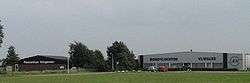
Hoogeveen Airport
| Hoogeveen Airport Vliegveld Hoogeveen | |||||||||||
|---|---|---|---|---|---|---|---|---|---|---|---|
 | |||||||||||
| IATA: none – ICAO: EHHO | |||||||||||
| Summary | |||||||||||
| Airport type | Public | ||||||||||
| Operator | Stichting Vliegveld Hoogeveen | ||||||||||
| Serves | Hoogeveen, Netherlands | ||||||||||
| Elevation AMSL | 40 ft / 12 m | ||||||||||
| Coordinates | 52°43′51″N 006°30′58″E / 52.73083°N 6.51611°ECoordinates: 52°43′51″N 006°30′58″E / 52.73083°N 6.51611°E | ||||||||||
| Website | vliegveldhoogeveen.nl | ||||||||||
| Runways | |||||||||||
| |||||||||||
Hoogeveen Airport (Dutch: Vliegveld Hoogeveen) (ICAO: EHHO) is a small general aviation airfield located 0.6 NM (1.1 km; 0.69 mi) northeast of Hoogeveen, a town in the northeastern Netherlands. There are several flying clubs and flying schools located at the airport. It has one grass runway with a length of 1,080 m (3,543 ft).
See also
References
- ↑ EHHO – HOOGEVEEN/Hoogeveen. AIP from AIS the Netherlands, effective 10 November 2016
- Vliegveld Hoogeveen (official website)
External links
- Airport information for EHHO at Great Circle Mapper.
This article is issued from Wikipedia - version of the 1/15/2016. The text is available under the Creative Commons Attribution/Share Alike but additional terms may apply for the media files.