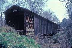
Howard's Covered Bridge
|
Howard's Covered Bridge | |
 | |
  | |
| Nearest city | Smithsonia, Georgia |
|---|---|
| Coordinates | 33°59′9″N 83°8′1″W / 33.98583°N 83.13361°WCoordinates: 33°59′9″N 83°8′1″W / 33.98583°N 83.13361°W |
| Area | less than one acre |
| Built | 1905 |
| Architectural style | Town Lattice |
| NRHP Reference # | 75000604[1] |
| Added to NRHP | July 1, 1975 |
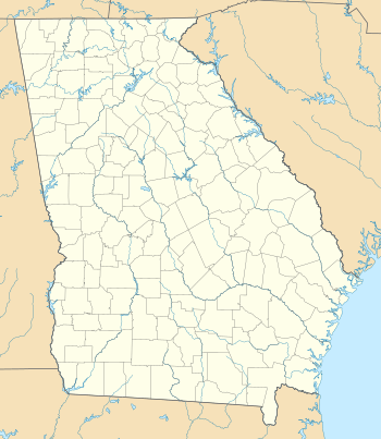
Howard's Covered Bridge is a historic covered bridge outside of Smithonia, Georgia in Oglethorpe County, Georgia. It was added to the National Register of Historic Places on July 1, 1975. The bridge is located 3 miles southeast of Smithonia on SR S2164. The bridge was built in 1905 in a Town lattice design and is 168 feet (51 m) long. The span travels over Big Clouds Creek. The site is marked by a historical marker posted by the Georgia Historical Society.[2] The bridge was named for the pioneer family that settled in the area in the late 1700s.[2] It was built with convict labor and is fastened with wooden trunnels.[2] The timber used was transported on the Smith and Dunlap Railroad, connecting James Monroe Smith (Georgia farmer)'s farm with the Georgia Railroad at Dunlap, Georgia.[2]
The site's historical marker is at the southern end of Chandler Silver Road at the intersection with Cloud's Creek Road, 1.3 miles west of the Cloud's Creek Baptist Church marker.[3]
See also
- National Register of Historic Places listings in Oglethorpe County, Georgia
- List of covered bridges in Georgia (U.S. state)
References
- ↑ National Park Service (2010-07-09). "National Register Information System". National Register of Historic Places. National Park Service.
- 1 2 3 4 Howard's Covered Bridge Historical Marker Georgia Info
- ↑ Howard's Covered Bridge Georgia Info (photograph and historical marker location information)