Huai Mek District
| Huai Mek ห้วยเม็ก | |
|---|---|
| Amphoe | |
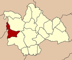 Amphoe location in Kalasin Province | |
| Coordinates: 16°35′24″N 103°14′8″E / 16.59000°N 103.23556°ECoordinates: 16°35′24″N 103°14′8″E / 16.59000°N 103.23556°E | |
| Country |
|
| Province | Kalasin |
| Area | |
| • Total | 291.01 km2 (112.36 sq mi) |
| Population (2005) | |
| • Total | 49,716 |
| • Density | 170.8/km2 (442/sq mi) |
| Time zone | ICT (UTC+7) |
| Postal code | 46240 |
| Geocode | 4608 |
Huai Mek (Thai: ห้วยเม็ก) is a district (amphoe) in the western part of Kalasin Province, northeastern Thailand.
Geography
Neighboring districts are (from the northeast clockwise) Nong Kung Si, Yang Talat of Kalasin Province, Chuen Chom of Maha Sarakham Province and Kranuan of Khon Kaen Province.
History
The minor district (king amphoe) was created on 1 November 1970, when the three tambon Huai Mek, Kut Don, and Bueng Na Riang were split off from Yang Talat district.[1] It was upgraded to a full district on 12 April 1977.[2]
Administration
The district is subdivided into nine subdistricts (tambon), which are further subdivided into 81 villages (muban). There are two townships (thesaban tambon). Huai Mek and Kham Yai each cover parts of the same-named tambon. There are a further nine tambon administrative organizations (TAO).
| No. | Name | Thai name | Villages | Inh. | |
|---|---|---|---|---|---|
| 1. | Huai Mek | ห้วยเม็ก | 12 | 9,094 | |
| 2. | Kham Yai | คำใหญ่ | 12 | 7,306 | |
| 3. | Kut Don | กุดโดน | 13 | 8,369 | |
| 4. | Bueng Na Riang | บึงนาเรียง | 7 | 3,955 | |
| 5. | Hua Hin | หัวหิน | 8 | 4,344 | |
| 6. | Phimun | พิมูล | 7 | 4,149 | |
| 7. | Kham Mueat Kaeo | คำเหมือดแก้ว | 9 | 5,788 | |
| 8. | Non Sa-at | โนนสะอาด | 7 | 4,091 | |
| 9. | Sai Thong | ทรายทอง | 6 | 2,620 |
References
- ↑ ประกาศกระทรวงมหาดไทย เรื่อง แบ่งท้องที่ตั้งเป็นกิ่งอำเภอ กิ่งอำเภอห้วยเม็ก (PDF). Royal Gazette (in Thai). 87 (101 ง special): 6. 1 Nov 1970.
- ↑ พระราชกฤษฎีกาตั้งอำเภอปลายพระยา อำเภอห้วยเม็ก อำเภอละแม อำเภอแม่จริม อำเภอหนองกี่ อำเภอโคกปีบ อำเภอเกาะพะงัน อำเภอสนม อำเภอโซ่พิสัย อำเภอโนนสะอาด และอำเภอนาจะหลวย พ.ศ. ๒๕๒๐ (PDF). Royal Gazette (in Thai). 94 (31 ก): 326–330. 12 Apr 1977.