Humberstone & Hamilton
Coordinates: 52°39′14″N 1°03′54″W / 52.654°N 1.065°W
| Humberstone & Hamilton | |
 |
|
| Population | 18,854 (2011) |
|---|---|
| Unitary authority | Leicester |
| Ceremonial county | Leicestershire |
| Region | East Midlands |
| Country | England |
| Sovereign state | United Kingdom |
| Post town | LEICESTER |
| Postcode district | LE5 |
| Dialling code | 0116 |
| Police | Leicestershire |
| Fire | Leicestershire |
| Ambulance | East Midlands |
| EU Parliament | East Midlands |
| UK Parliament | Leicester East |
|
|
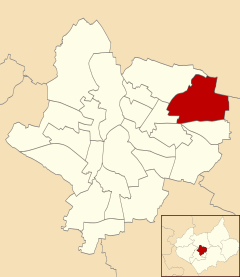
Humberstone & Hamilton is an electoral ward and administrative division of the City of Leicester, England. It comprises the north-eastern Leicester suburbs of Humberstone, Humberstone Garden City, Hamilton and Netherhall.
Geography
Humberstone & Hamilton is bordered by the wards of Rushey Mead to the north, Charnwood to the east and Coleman and Thurncourt to the south.[1] The ward borders the county of Leicestershire; in particular, the borough of Charnwood to the north and the district of Harborough to the east.
The ward comprises the suburb of Humberstone in the west, Netherhall in the southeast and Hamilton to the northeast (which makes Hamilton the most northeasterly suburb of Leicester).
History
Name
The ward takes its name from the historical village of Humberstone and the modern housing estate of Hamilton. The place-name 'Humberstone' is first attested in the Domesday Book of 1086, where it appears as 'Humerstane'. The name means 'Hunbeorht's stone'.[2] The "Humber stone" is a granite monolith of unknown (perhaps glacial) origin that lies in a field in Hamilton. Until 1750 it had been fully exposed, but was then truncated and the remainder buried by a farmer. In the 1980s it was partially uncovered and made accessible to the public. It was then fenced in when the Leicester north ring road was built and had a sign erected at the site, describing the stone's history.
Hamilton was named after a deserted medieval village in the civil parish of Barkby Thorpe, just outside the Leicester city boundary. The name is being revived for new developments on the A563 road, east of Rushey Mead.[3]
Medieval history
The village of Humberstone has been inhabited for many centuries. Part of the wall around the local St Mary's church is an original cob wall. There is also a thatched cottage dating from a similar time. Most of the houses in Humberstone were built in the 1920s on land that used to be part of the estate of Humberstone Manor. Some of the gardens in the area bear testament to this as they still have parts of the century-old orchard trees in them.
Humberstone was annexed to the city in 1935. In the late 1980s and early 1990s several private gardens were sold to property developers, but a combination of local hostility and a crash in the property market resulted in the land becoming disused. It has since been taken over by the council and converted into a public garden.
Humberstone Garden development
The development of Humberstone Garden was based on the principles of the Garden city movement. Garden suburbs modified the principles of garden cities to allow for residential "garden suburbs" without the commercial and industrial components of the garden city. They were built on the outskirts of cities, in rural settings such as Humberstone.
The Humberstone Garden Suburb is notable because it is the only example in which a UK workers cooperative has created a housing cooperative and built a housing estate for its members. The Anchor Tenants Housing Association was formed in 1887 by the workers cooperative of the Anchor Boot and Shoe Co-operative Society which was a cooperatively run boot and shoe works in Asfordby Street, Leicester. The members of the cooperative contributed a percentage of their wages and bought a plot of land just outside Leicester by the village of Humberstone and built 97 houses. The first houses were in use by 1908 and the Anchor employees were let houses by the association at a rent that was collected to cover the upkeep of the properties.[4] The original houses were designed by George Hern in a roughcast cottage style at a density of 7 to 8 houses an acre. The suburb consists of houses in Lilac Avenue, Laburnum Road, Fern Rise, Chestnut Avenue and a part of Keyham Lane. The names of the new streets were chosen to emphasise the garden nature of the scheme.[5]
Demographics
Humberstone & Hamilton had a population of 11,893 at the 2001 census. The ward had a relatively older population, with the greatest share of the area's residents being between the ages of 30 and 59.
Compared to some Leicester wards, Humberstone & Hamilton's Asian population is a minority at 19%, with a 73% white British population.[6]
In 2011 however, 43.8% of the population of this ward were White British, 40.1% were Asian and 4.4% Black.[7]
Amenities and facilities
Until the mid-1980s Humberstone village had two pubs, The Humberstone (which still exists and which in about 1960 replaced The Plough which stood closer to the road ) and The Windmill (which lay derelict until the late 1990s when it was demolished). The village is also home to two members' clubs, the Humberstone Royal British Legion and the Old Humberstone Constitutional Club.
The original public library was on Main Street - a small building on the left hand side going down the hill which resembled a non-conformist chapel. This was eventually replaced by a public library situated next to the school, but was relocated to the car park of the nearby Hamilton Tesco Extra store in the mid-2000s.
Humberstone has a bowls club and a youth football club, Humberstone Rangers. There was a tennis club in the village until the mid-2000s when it was demolished and houses built there. The local golf club, Humberstone Heights, is one of the few council-run clubs in the city.
When it was built, Humberstone Garden Suburb had a bowling green, a cricket pitch, a skittle alley, a football ground, tennis courts and golf links.[8] These facilities and the shoe factory no longer exist but the housing estate remains intact.
Education
Humberstone Nursery, Infants and Junior School are located adjacent to each other in Humberstone. Humberstone Juniors converted to an academy in 2012. In 2014 Falcons Primary School opened in the area. It is a Sikh free school.[9]
There are two primary schools in Hamilton; Kestrel's Field Primary School, which opened in the early 1990s, and Hope Hamilton, which is Church of England aided.
Hamilton Community College is attended by students between the ages of 11 to 16. Nearby Keyham Lodge School is an all-boys school for 11-16s with learning disabilities and behavioural problems. Gateway Sixth Form College has recently opened a building opposite the Tesco store, with a pedestrian footbridge across the outer ring road between the college and Tesco.
Transport
Humberstone & Hamilton are served by the following bus companies and services; First Leicester routes 21A & 38/38A, Arriva Fox County services 53/53A, 56, 58/58A and Centrebus services 40, 747 and UHL.
Humberstone used to have a station on the Leicester spur of the Great Northern Railway, named Humberstone Railway Station. This was on Uppingham Road to the west of the old village. Further to the west, Humberstone Road railway station was on the Midland Main Line.
Politics
Humberstone & Hamilton is part of the Leicester East constituency, a traditionally safe Labour seat.
References
| Wikimedia Commons has media related to Humberstone, Leicester. |
- ↑ Leicester City Council. "Ward Maps". Retrieved 11 October 2011.
- ↑ Eilert Ekwall, Concise Oxford Dictionary of English Place-names, p.256.
- ↑ http://www.leicester.gov.uk/index.asp?pgid=8276 leicester.gov.uk
- ↑ "Humberstone Garden Suburb". Utopia-britannica.org.uk. Retrieved 10 January 2010.
- ↑ Pevsner, Nikolaus (1984). Buildings of England:Leicestershire and Rutland (2nd ed.). Penguin. p. 273.
- ↑ Leicester City Council. "Ward Profiles – 2001 Census – Population". Retrieved 14 November 2011.
- ↑ http://www.ukcensusdata.com/humberstone-and-hamilton-e05001796#sthash.qIURpHZW.dpbs
- ↑ "Humberstone Garden Suburb – A History" (PDF). Retrieved 10 January 2010.
- ↑ http://www.bbc.co.uk/news/uk-england-leicestershire-29415598