Illington
| Illington | |
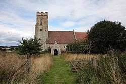 Saint Andrew Parish Church, Illington |
|
 Illington |
|
| Population | 366 (parish, 2001 census) |
|---|---|
| OS grid reference | TL9489 |
| – London | 92.3 miles (148.5 km) |
| Civil parish | Wretham CP |
| District | Breckland |
| Shire county | Norfolk |
| Region | East |
| Country | England |
| Sovereign state | United Kingdom |
| Post town | THETFORD |
| Postcode district | IP24 |
| Dialling code | 01953 |
| Police | Norfolk |
| Fire | Norfolk |
| Ambulance | East of England |
| EU Parliament | East of England |
Coordinates: 52°28′23″N 0°52′01″E / 52.47308°N 0.866831°E
Illington is a village and a civil parish in the English county of Norfolk.[1] The population is included in the civil pariah of Wretham. The village is 6.2 miles north east of Thetford, 24 miles west south west of Norwich and 92.3 miles north east of London.[2] The nearest railway station is at Thetford for the Breckland Line which runs between Cambridge and Norwich. The nearest airport is Norwich International Airport.
History
Illington has an entry in the Domesday Book of 1085.[3] In the great book Illington is recorded by the name ‘’Illinketune’’. The main landholder is William de Warenne
References
External links
| Wikimedia Commons has media related to Illington. |
- Map sources for Illington
This article is issued from Wikipedia - version of the 8/7/2016. The text is available under the Creative Commons Attribution/Share Alike but additional terms may apply for the media files.